Buchloe elevation
Buchloe (Bavaria, Swabia), Germany elevation is 615 meters and Buchloe elevation in feet is 2018 ft above sea level [src 1]. Buchloe is a populated place (feature code) with elevation that is 357 meters (1171 ft) bigger than average city elevation in Germany.
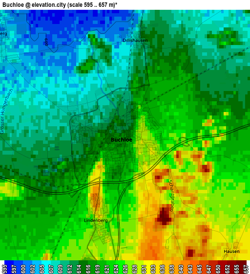
Below is the Elevation map of Buchloe, which displays elevation range with different colors. Scale of the first map is from 595 to 657 m (1952 to 2156 ft) with average elevation of 617.9 meters (=2027 ft) [note 1]
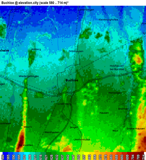
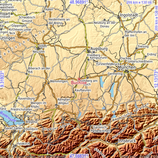
These maps also provides idea of topography and contour of this city, they are displayed at different zoom levels. More info about maps, scale and edge coordinates you can find below images.
| \ | Map #1 | Map #2 | Topo.Map |
| Scale [m] | 595..657 m | 580..714 m | × |
| Scale [ft] | 1952..2156 ft | 1903..2343 ft | × |
| Average | 617.9 m = 2027 ft | 618.3 m = 2029 ft | × |
| Width | 6.53 km = 4.1 mi | 13.07 km = 8.1 mi | 209.1 km = 129.9 mi |
| Height | 6.53 km = 4.1 mi | 13.07 km = 8.1 mi | 209.1 km = 129.9 mi |
| ↑Max Latitude | 48.066566° | 48.095924° | 48.96891° |
| Latitude at center | 48.03719° | 48.03719° | 48.03719° |
| ↓Min Latitude | 48.007798° | 47.978389° | 47.08831° |
| ← Min Longitude | 10.681535° | 10.637589° | 9.31923° |
| Longitude center | 10.72548° | 10.72548° | 10.72548° |
| →Max Longitude | 10.769425° | 10.813371° | 12.13173° |
Nearby cities:
Cities around Buchloe sort by population:
• Bad Wörishofen elevation 625 m
10.2 km,  250°
250°
• Türkheim 599 m
6.9 km,  295°
295°
• Ettringen 583 m
9 km,  321°
321°
• Jengen 637 m
4.2 km,  179°
179°
• Waal 633 m
5.9 km,  139°
139°
• Lamerdingen 597 m
6.2 km,  9°
9°
• Hurlach 580 m
11 km,  35°
35°
• Wiedergeltingen 612 m
3.8 km,  273°
273°
• Unterdießen 635 m
10 km,  126°
126°
• Amberg 599 m
4.5 km, 316°
• Oberostendorf 677 m
10.5 km,  172°
172°
• Rieden 659 m
11.2 km,  210°
210°
Multilingual:
 En español:
Buchloe elevación 615 m.
 En France:
Buchloe élévation 615 m.


Sources and notes:
- [note 1] Map square and city borders are not equal. Map elevation data is calculated only from area inside that square.
- [src 1] Elevation data from geonames database provided with same terms of usage.
- [src 2] The elevation map of Buchloe is generated using elevation data from NASA's 3 arcsec (90m) resolution SRTM data.
- [src 3] Base (background) map © OpenStreetMap contributors tiles are generated by Geofabrik and OpenTopoMap.
Copyright & License:
This Buchloe Elevation Map is licensed under CC BY-SA. You may reuse any part from this page, if you give a proper credit by linking to this URL:
 More info on terms of use page.