Budenheim elevation
Budenheim (Rheinland-Pfalz), Germany elevation is 105 meters and Budenheim elevation in feet is 344 ft above sea level [src 1]. Budenheim is a seat of a fourth-order administrative division (feature code) with elevation that is 153 meters (502 ft) smaller than average city elevation in Germany.
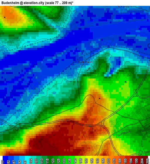
Below is the Elevation map of Budenheim, which displays elevation range with different colors. Scale of the first map is from 77 to 209 m (253 to 686 ft) with average elevation of 121.1 meters (=397 ft) [note 1]
These maps also provides idea of topography and contour of this city, they are displayed at different zoom levels. More info about maps, scale and edge coordinates you can find below images.
| \ | Map #1 | Map #2 | Topo.Map |
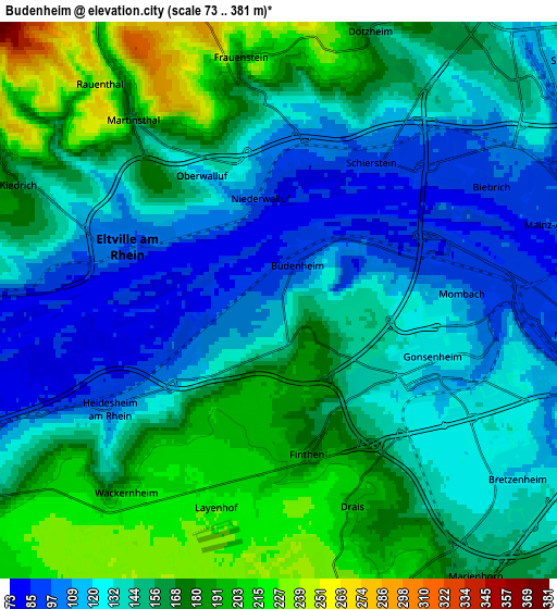
| Scale [m] | 77..209 m | 73..381 m | × |
| Scale [ft] | 253..686 ft | 240..1250 ft | × |
| Average | 121.1 m = 397 ft | 149.8 m = 491 ft | × |
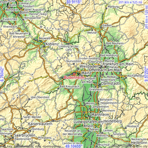
| Width | 6.28 km = 3.9 mi | 12.56 km = 7.8 mi | 200.9 km = 124.8 mi |
| Height | 6.28 km = 3.9 mi | 12.56 km = 7.8 mi | 200.9 km = 124.8 mi |
| ↑Max Latitude | 50.044899° | 50.073112° | 50.9118° |
| Latitude at center | 50.01667° | 50.01667° | 50.01667° |
| ↓Min Latitude | 49.988424° | 49.960161° | 49.10455° |
| ← Min Longitude | 8.122725° | 8.078779° | 6.76042° |
| Longitude center | 8.16667° | 8.16667° | 8.16667° |
| →Max Longitude | 8.210615° | 8.254561° | 9.57292° |
Nearby cities:
Cities around Budenheim sort by population:
• Wiesbaden elevation 128 m
9.4 km,  38°
38°
• Mainz 126 m
8.8 km,  114°
114°
• Ingelheim am Rhein 113 m
9.2 km,  236°
236°
• Nieder-Ingelheim 135 m
8 km, 237°
• Eltville 99 m
3.8 km,  290°
290°
• Schlangenbad 287 m
9.6 km,  331°
331°
• Walluf 118 m
2.7 km,  342°
342°
• Ober-Olm 221 m
9 km,  169°
169°
• Kiedrich 161 m
6.3 km, 293°
• Klein-Winternheim 156 m
9.3 km,  159°
159°
• Essenheim 219 m
9.6 km,  184°
184°
• Wackernheim 213 m
5.9 km,  217°
217°
Multilingual:
 En español:
Budenheim elevación 105 m.
 En France:
Budenheim élévation 105 m.
 Auf Deutsch:
Budenheim höhe über dem Meeresspiegel ist 105 m.

Sources and notes:
- [note 1] Map square and city borders are not equal. Map elevation data is calculated only from area inside that square.
- [src 1] Elevation data from geonames database provided with same terms of usage.
- [src 2] The elevation map of Budenheim is generated using elevation data from NASA's 3 arcsec (90m) resolution SRTM data.
- [src 3] Base (background) map © OpenStreetMap contributors tiles are generated by Geofabrik and OpenTopoMap.
Copyright & License:
This Budenheim Elevation Map is licensed under CC BY-SA. You may reuse any part from this page, if you give a proper credit by linking to this URL:
 More info on terms of use page.