Bufleben elevation
Bufleben (Thuringia), Germany elevation is 281 meters and Bufleben elevation in feet is 922 ft above sea level [src 1]. Bufleben is a seat of a fourth-order administrative division (feature code) with elevation that is 23 meters (75 ft) bigger than average city elevation in Germany.
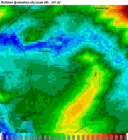
Below is the Elevation map of Bufleben, which displays elevation range with different colors. Scale of the first map is from 265 to 331 m (869 to 1086 ft) with average elevation of 286.1 meters (=939 ft) [note 1]
These maps also provides idea of topography and contour of this city, they are displayed at different zoom levels. More info about maps, scale and edge coordinates you can find below images.
| \ | Map #1 | Topo.Map |
| Scale [m] | 265..331 m | × |
| Scale [ft] | 869..1086 ft | × |
| Average | 286.1 m = 939 ft | × |
| Width | 6.15 km = 3.8 mi | 196.8 km = 122.3 mi |
| Height | 6.15 km = 3.8 mi | 196.8 km = 122.3 mi |
| ↑Max Latitude | 51.027647° | 51.87656° |
| Latitude at center | 51° | 51° |
| ↓Min Latitude | 50.972336° | 50.10656° |
| ← Min Longitude | 10.689385° | 9.32708° |
| Longitude center | 10.73333° | 10.73333° |
| →Max Longitude | 10.777275° | 12.13958° |
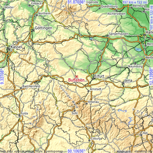
Nearby cities:
Cities around Bufleben sort by population:
• Gotha elevation 305 m
6.2 km,  200°
200°
• Bad Langensalza 192 m
13.4 km,  332°
332°
• Wandersleben 265 m
13.8 km,  143°
143°
• Dachwig 177 m
12.1 km,  44°
44°
• Seebergen 287 m
9.9 km,  152°
152°
• Hörselgau 301 m
13.7 km,  229°
229°
• Sonneborn 263 m
9.9 km,  265°
265°
• Döllstädt 204 m
10.9 km,  32°
32°
• Friemar 287 m
4.6 km,  123°
123°
• Molschleben 290 m
3.5 km,  90°
90°
• Witterda 230 m
11.7 km,  69°
69°
• Grabsleben 292 m
10 km,  134°
134°
Multilingual:
 En español:
Bufleben elevación 281 m.
 En France:
Bufleben élévation 281 m.
 Auf Deutsch:
Bufleben höhe über dem Meeresspiegel ist 281 m.

Sources and notes:
- [note 1] Map square and city borders are not equal. Map elevation data is calculated only from area inside that square.
- [src 1] Elevation data from geonames database provided with same terms of usage.
- [src 2] The elevation map of Bufleben is generated using elevation data from NASA's 3 arcsec (90m) resolution SRTM data.
- [src 3] Base (background) map © OpenStreetMap contributors tiles are generated by Geofabrik and OpenTopoMap.
Copyright & License:
This Bufleben Elevation Map is licensed under CC BY-SA. You may reuse any part from this page, if you give a proper credit by linking to this URL:
 More info on terms of use page.