Gotha elevation
Gotha (Thuringia), Germany elevation is 305 meters and Gotha elevation in feet is 1001 ft above sea level [src 1]. Gotha is a seat of a third-order administrative division (feature code) with elevation that is 47 meters (154 ft) bigger than average city elevation in Germany.
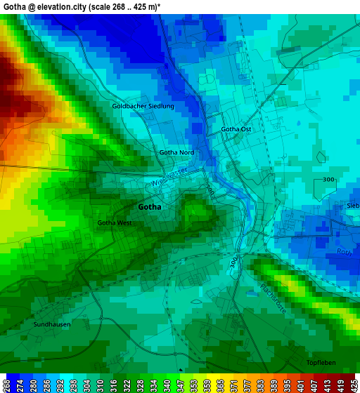
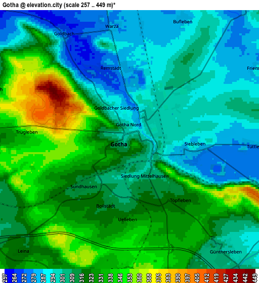
Below is the Elevation map of Gotha, which displays elevation range with different colors. Scale of the first map is from 268 to 425 m (879 to 1394 ft) with average elevation of 311.2 meters (=1021 ft) [note 1]
These maps also provides idea of topography and contour of this city, they are displayed at different zoom levels. More info about maps, scale and edge coordinates you can find below images.
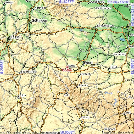
| \ | Map #1 | Map #2 | Topo.Map |
| Scale [m] | 268..425 m | 257..449 m | × |
| Scale [ft] | 879..1394 ft | 843..1473 ft | × |
| Average | 311.2 m = 1021 ft | 314.6 m = 1032 ft | × |
| Width | 6.16 km = 3.8 mi | 12.31 km = 7.6 mi | 197 km = 122.4 mi |
| Height | 6.16 km = 3.8 mi | 12.31 km = 7.6 mi | 197 km = 122.4 mi |
| ↑Max Latitude | 50.975908° | 51.00357° | 51.82577° |
| Latitude at center | 50.94823° | 50.94823° | 50.94823° |
| ↓Min Latitude | 50.920535° | 50.892824° | 50.0538° |
| ← Min Longitude | 10.657985° | 10.614039° | 9.29568° |
| Longitude center | 10.70193° | 10.70193° | 10.70193° |
| →Max Longitude | 10.745875° | 10.789821° | 12.10818° |
Nearby cities:
Cities around Gotha sort by population:
• Waltershausen elevation 330 m
11.5 km,  241°
241°
• Georgenthal 383 m
13.2 km,  192°
192°
• Wandersleben 265 m
11.7 km,  117°
117°
• Seebergen 287 m
7.5 km,  114°
114°
• Hörselgau 301 m
8.8 km,  249°
249°
• Sonneborn 263 m
9.2 km,  302°
302°
• Friemar 287 m
6.9 km,  62°
62°
• Molschleben 290 m
8.1 km,  44°
44°
• Mechterstädt 276 m
12.5 km,  266°
266°
• Bufleben 281 m
6.2 km,  20°
20°
• Grabsleben 292 m
9.4 km,  98°
98°
• Ernstroda 361 m
10.9 km,  211°
211°
Multilingual:
 En español:
Gotha elevación 305 m.
 En France:
Gotha élévation 305 m.


Sources and notes:
- [note 1] Map square and city borders are not equal. Map elevation data is calculated only from area inside that square.
- [src 1] Elevation data from geonames database provided with same terms of usage.
- [src 2] The elevation map of Gotha is generated using elevation data from NASA's 3 arcsec (90m) resolution SRTM data.
- [src 3] Base (background) map © OpenStreetMap contributors tiles are generated by Geofabrik and OpenTopoMap.
Copyright & License:
This Gotha Elevation Map is licensed under CC BY-SA. You may reuse any part from this page, if you give a proper credit by linking to this URL:
 More info on terms of use page.