Colmberg elevation
Colmberg (Bavaria, Regierungsbezirk Mittelfranken), Germany elevation is 451 meters and Colmberg elevation in feet is 1480 ft above sea level [src 1]. Colmberg is a populated place (feature code) with elevation that is 193 meters (633 ft) bigger than average city elevation in Germany.
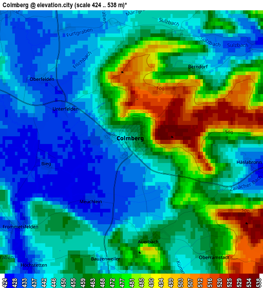
Below is the Elevation map of Colmberg, which displays elevation range with different colors. Scale of the first map is from 424 to 538 m (1391 to 1765 ft) with average elevation of 456.6 meters (=1498 ft) [note 1]
These maps also provides idea of topography and contour of this city, they are displayed at different zoom levels. More info about maps, scale and edge coordinates you can find below images.
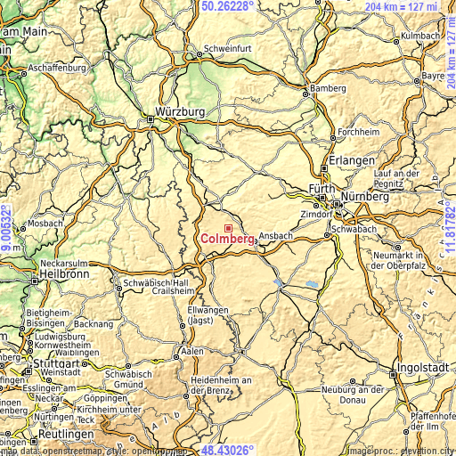
| \ | Map #1 | Topo.Map |
| Scale [m] | 424..538 m | × |
| Scale [ft] | 1391..1765 ft | × |
| Average | 456.6 m = 1498 ft | × |
| Width | 6.37 km = 4 mi | 203.7 km = 126.6 mi |
| Height | 6.37 km = 4 mi | 203.7 km = 126.6 mi |
| ↑Max Latitude | 49.383416° | 50.26228° |
| Latitude at center | 49.3548° | 49.3548° |
| ↓Min Latitude | 49.326167° | 48.43026° |
| ← Min Longitude | 10.367625° | 9.00532° |
| Longitude center | 10.41157° | 10.41157° |
| →Max Longitude | 10.455515° | 11.81782° |
Nearby cities:
Cities around Colmberg sort by population:
• Leutershausen elevation 430 m
6.2 km,  179°
179°
• Lehrberg 423 m
7.3 km,  98°
98°
• Burgbernheim 341 m
12.4 km,  329°
329°
• Schillingsfürst 515 m
13.1 km,  235°
235°
• Obernzenn 373 m
11.5 km,  20°
20°
• Flachslanden 465 m
8.8 km,  56°
56°
• Neusitz 414 m
13.6 km,  278°
278°
• Oberdachstetten 483 m
7.1 km,  12°
12°
• Marktbergel 364 m
10.3 km,  340°
340°
• Geslau 443 m
7.1 km, 280°
• Rügland 390 m
13.4 km,  67°
67°
• Windelsbach 452 m
9.5 km,  301°
301°
Multilingual:
 En español:
Colmberg elevación 451 m.
 En France:
Colmberg élévation 451 m.
 Auf Deutsch:
Colmberg höhe über dem Meeresspiegel ist 451 m.

Sources and notes:
- [note 1] Map square and city borders are not equal. Map elevation data is calculated only from area inside that square.
- [src 1] Elevation data from geonames database provided with same terms of usage.
- [src 2] The elevation map of Colmberg is generated using elevation data from NASA's 3 arcsec (90m) resolution SRTM data.
- [src 3] Base (background) map © OpenStreetMap contributors tiles are generated by Geofabrik and OpenTopoMap.
Copyright & License:
This Colmberg Elevation Map is licensed under CC BY-SA. You may reuse any part from this page, if you give a proper credit by linking to this URL:
 More info on terms of use page.