Rügland elevation
Rügland (Bavaria, Regierungsbezirk Mittelfranken), Germany elevation is 390 meters and Rügland elevation in feet is 1280 ft above sea level [src 1]. Rügland is a seat of a fourth-order administrative division (feature code) with elevation that is 132 meters (433 ft) bigger than average city elevation in Germany.
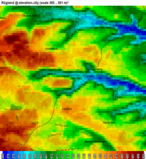
Below is the Elevation map of Rügland, which displays elevation range with different colors. Scale of the first map is from 365 to 501 m (1198 to 1644 ft) with average elevation of 436.2 meters (=1431 ft) [note 1]
These maps also provides idea of topography and contour of this city, they are displayed at different zoom levels. More info about maps, scale and edge coordinates you can find below images.
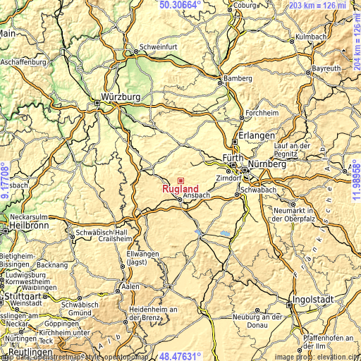
| \ | Map #1 | Topo.Map |
| Scale [m] | 365..501 m | × |
| Scale [ft] | 1198..1644 ft | × |
| Average | 436.2 m = 1431 ft | × |
| Width | 6.36 km = 4 mi | 203.5 km = 126.4 mi |
| Height | 6.36 km = 4 mi | 203.5 km = 126.4 mi |
| ↑Max Latitude | 49.42859° | 50.30664° |
| Latitude at center | 49.4° | 49.4° |
| ↓Min Latitude | 49.371393° | 48.47631° |
| ← Min Longitude | 10.539385° | 9.17708° |
| Longitude center | 10.58333° | 10.58333° |
| →Max Longitude | 10.627275° | 11.98958° |
Nearby cities:
Cities around Rügland sort by population:
• Ansbach elevation 451 m
10.6 km,  176°
176°
• Adelsdorf 328 m
10.7 km,  43°
43°
• Markt Erlbach 388 m
11.6 km,  25°
25°
• Dietenhofen 344 m
7.7 km,  90°
90°
• Lehrberg 423 m
8 km,  220°
220°
• Weihenzell 399 m
6.1 km,  156°
156°
• Obernzenn 373 m
10.2 km,  304°
304°
• Flachslanden 465 m
5.1 km,  268°
268°
• Neuhof an der Zenn 330 m
7.8 km, 35°
• Oberdachstetten 483 m
11 km,  279°
279°
• Bruckberg 340 m
9.5 km,  117°
117°
• Trautskirchen 350 m
6.5 km,  6°
6°
Multilingual:
 En español:
Rügland elevación 390 m.
 En France:
Rügland élévation 390 m.


Sources and notes:
- [note 1] Map square and city borders are not equal. Map elevation data is calculated only from area inside that square.
- [src 1] Elevation data from geonames database provided with same terms of usage.
- [src 2] The elevation map of Rügland is generated using elevation data from NASA's 3 arcsec (90m) resolution SRTM data.
- [src 3] Base (background) map © OpenStreetMap contributors tiles are generated by Geofabrik and OpenTopoMap.
Copyright & License:
This Rügland Elevation Map is licensed under CC BY-SA. You may reuse any part from this page, if you give a proper credit by linking to this URL:
 More info on terms of use page.