Cremlingen elevation
Cremlingen (Lower Saxony), Germany elevation is 113 meters and Cremlingen elevation in feet is 371 ft above sea level [src 1]. Cremlingen is a seat of a fourth-order administrative division (feature code) with elevation that is 145 meters (476 ft) smaller than average city elevation in Germany.
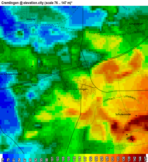
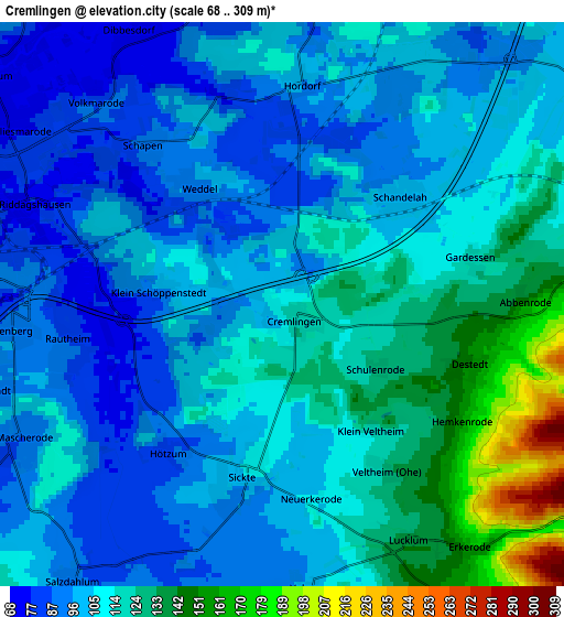
Below is the Elevation map of Cremlingen, which displays elevation range with different colors. Scale of the first map is from 76 to 147 m (249 to 482 ft) with average elevation of 104.8 meters (=344 ft) [note 1]
These maps also provides idea of topography and contour of this city, they are displayed at different zoom levels. More info about maps, scale and edge coordinates you can find below images.
| \ | Map #1 | Map #2 | Topo.Map |
| Scale [m] | 76..147 m | 68..309 m | × |
| Scale [ft] | 249..482 ft | 223..1014 ft | × |
| Average | 104.8 m = 344 ft | 109.4 m = 359 ft | × |
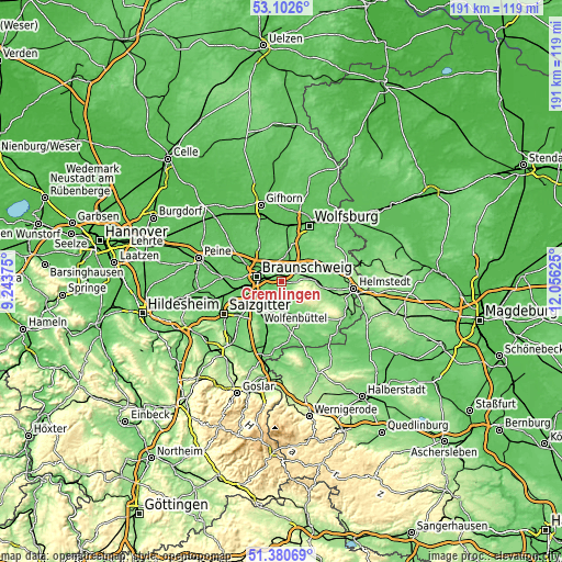
| Width | 5.98 km = 3.7 mi | 11.97 km = 7.4 mi | 191.5 km = 119 mi |
| Height | 5.98 km = 3.7 mi | 11.97 km = 7.4 mi | 191.4 km = 118.9 mi |
| ↑Max Latitude | 52.276896° | 52.303776° | 53.1026° |
| Latitude at center | 52.25° | 52.25° | 52.25° |
| ↓Min Latitude | 52.223088° | 52.196159° | 51.38069° |
| ← Min Longitude | 10.606055° | 10.562109° | 9.24375° |
| Longitude center | 10.65° | 10.65° | 10.65° |
| →Max Longitude | 10.693945° | 10.737891° | 12.05625° |
Nearby cities:
Cities around Cremlingen sort by population:
• Braunschweig elevation 72 m
8.6 km,  281°
281°
• Wolfenbüttel 80 m
12.1 km,  217°
217°
• Königslutter am Elm 136 m
11.4 km,  89°
89°
• Lehre 76 m
9.3 km,  6°
6°
• Sickte 110 m
3.5 km,  188°
188°
• Leiferde 76 m
10.9 km,  242°
242°
• Bevenrode 87 m
11.2 km,  333°
333°
• Destedt 154 m
4.3 km,  107°
107°
• Evessen 146 m
8 km,  148°
148°
• Dettum 94 m
8.7 km,  171°
171°
• Erkerode 176 m
6.5 km,  140°
140°
• Veltheim 129 m
4.1 km, 146°
Multilingual:
 En español:
Cremlingen elevación 113 m.
 En France:
Cremlingen élévation 113 m.
 Auf Deutsch:
Cremlingen höhe über dem Meeresspiegel ist 113 m.

Sources and notes:
- [note 1] Map square and city borders are not equal. Map elevation data is calculated only from area inside that square.
- [src 1] Elevation data from geonames database provided with same terms of usage.
- [src 2] The elevation map of Cremlingen is generated using elevation data from NASA's 3 arcsec (90m) resolution SRTM data.
- [src 3] Base (background) map © OpenStreetMap contributors tiles are generated by Geofabrik and OpenTopoMap.
Copyright & License:
This Cremlingen Elevation Map is licensed under CC BY-SA. You may reuse any part from this page, if you give a proper credit by linking to this URL:
 More info on terms of use page.