Dankmarshausen elevation
Dankmarshausen (Thuringia), Germany elevation is 230 meters and Dankmarshausen elevation in feet is 755 ft above sea level [src 1]. Dankmarshausen is a seat of a fourth-order administrative division (feature code) with elevation that is 28 meters (92 ft) smaller than average city elevation in Germany.
Below is the Elevation map of Dankmarshausen, which displays elevation range with different colors. Scale of the first map is from 203 to 503 m (666 to 1650 ft) with average elevation of 250.5 meters (=822 ft) [note 1]
These maps also provides idea of topography and contour of this city, they are displayed at different zoom levels. More info about maps, scale and edge coordinates you can find below images.
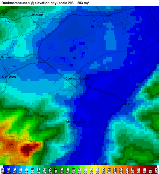
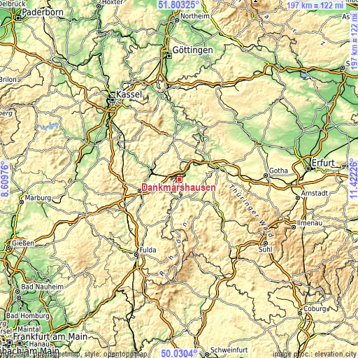
| \ | Map #1 | Topo.Map |
| Scale [m] | 203..503 m | × |
| Scale [ft] | 666..1650 ft | × |
| Average | 250.5 m = 822 ft | × |
| Width | 6.16 km = 3.8 mi | 197.1 km = 122.5 mi |
| Height | 6.16 km = 3.8 mi | 197.1 km = 122.5 mi |
| ↑Max Latitude | 50.952962° | 51.80325° |
| Latitude at center | 50.92527° | 50.92527° |
| ↓Min Latitude | 50.897562° | 50.0304° |
| ← Min Longitude | 9.972065° | 8.60976° |
| Longitude center | 10.01601° | 10.01601° |
| →Max Longitude | 10.059955° | 11.42226° |
Nearby cities:
Cities around Dankmarshausen sort by population:
• Heringen elevation 229 m
4.2 km,  188°
188°
• Philippsthal 234 m
9.6 km,  182°
182°
• Unterbreizbach 236 m
12.3 km, 190°
• Gerstungen 218 m
5.8 km,  37°
37°
• Vacha 237 m
10.8 km, 177°
• Marksuhl 251 m
12.9 km,  94°
94°
• Nentershausen 287 m
11.7 km,  330°
330°
• Dorndorf 250 m
11.3 km,  152°
152°
• Friedewald 392 m
11.5 km,  245°
245°
• Ronshausen 219 m
12 km,  283°
283°
• Dippach 218 m
2 km,  108°
108°
• Lauchröden 205 m
12.5 km,  52°
52°
Multilingual:
 En español:
Dankmarshausen elevación 230 m.
 En France:
Dankmarshausen élévation 230 m.
 Auf Deutsch:
Dankmarshausen höhe über dem Meeresspiegel ist 230 m.

Sources and notes:
- [note 1] Map square and city borders are not equal. Map elevation data is calculated only from area inside that square.
- [src 1] Elevation data from geonames database provided with same terms of usage.
- [src 2] The elevation map of Dankmarshausen is generated using elevation data from NASA's 3 arcsec (90m) resolution SRTM data.
- [src 3] Base (background) map © OpenStreetMap contributors tiles are generated by Geofabrik and OpenTopoMap.
Copyright & License:
This Dankmarshausen Elevation Map is licensed under CC BY-SA. You may reuse any part from this page, if you give a proper credit by linking to this URL:
 More info on terms of use page.