Dielheim elevation
Dielheim (Baden-Württemberg, Karlsruhe Region), Germany elevation is 151 meters and Dielheim elevation in feet is 495 ft above sea level [src 1]. Dielheim is a seat of a fourth-order administrative division (feature code) with elevation that is 107 meters (351 ft) smaller than average city elevation in Germany.
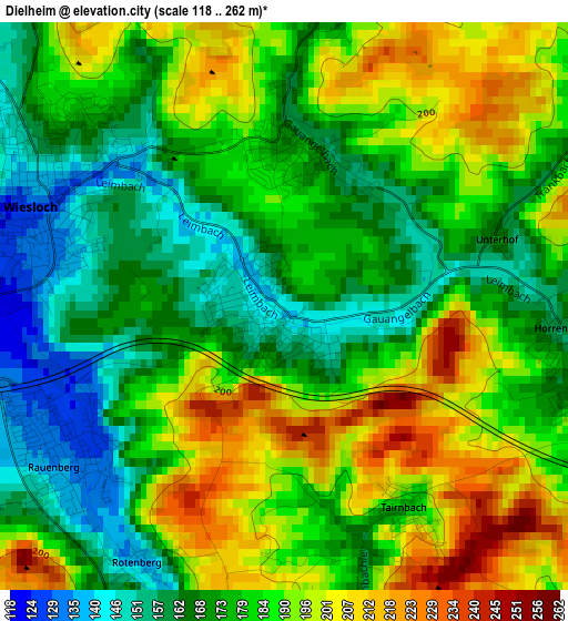
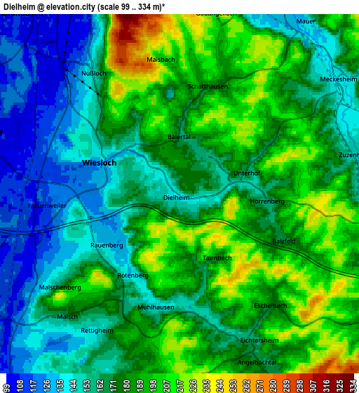
Below is the Elevation map of Dielheim, which displays elevation range with different colors. Scale of the first map is from 118 to 262 m (387 to 860 ft) with average elevation of 181.2 meters (=594 ft) [note 1]
These maps also provides idea of topography and contour of this city, they are displayed at different zoom levels. More info about maps, scale and edge coordinates you can find below images.
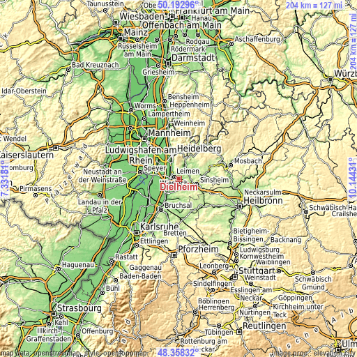
| \ | Map #1 | Map #2 | Topo.Map |
| Scale [m] | 118..262 m | 99..334 m | × |
| Scale [ft] | 387..860 ft | 325..1096 ft | × |
| Average | 181.2 m = 594 ft | 174.4 m = 572 ft | × |
| Width | 6.37 km = 4 mi | 12.75 km = 7.9 mi | 204 km = 126.8 mi |
| Height | 6.37 km = 4 mi | 12.75 km = 7.9 mi | 204 km = 126.8 mi |
| ↑Max Latitude | 49.312828° | 49.341468° | 50.19296° |
| Latitude at center | 49.28417° | 49.28417° | 49.28417° |
| ↓Min Latitude | 49.255496° | 49.226805° | 48.35832° |
| ← Min Longitude | 8.694115° | 8.650169° | 7.33181° |
| Longitude center | 8.73806° | 8.73806° | 8.73806° |
| →Max Longitude | 8.782005° | 8.825951° | 10.14431° |
Nearby cities:
Cities around Dielheim sort by population:
• Wiesloch elevation 134 m
3.1 km,  292°
292°
• Walldorf 105 m
7.4 km, 289°
• Östringen 163 m
7.5 km,  194°
194°
• Nußloch 149 m
5.4 km,  325°
325°
• Mühlhausen 143 m
4 km, 191°
• Rauenberg 131 m
3 km,  236°
236°
• Meckesheim 144 m
7.2 km,  54°
54°
• Mauer 141 m
7.7 km,  35°
35°
• Malsch 181 m
5.7 km,  224°
224°
• Zuzenhausen 149 m
6.3 km,  77°
77°
• Horrenberg 156 m
3.1 km,  97°
97°
• Balzfeld 171 m
4.1 km,  114°
114°
Multilingual:
 En español:
Dielheim elevación 151 m.
 En France:
Dielheim élévation 151 m.
 Auf Deutsch:
Dielheim höhe über dem Meeresspiegel ist 151 m.

Sources and notes:
- [note 1] Map square and city borders are not equal. Map elevation data is calculated only from area inside that square.
- [src 1] Elevation data from geonames database provided with same terms of usage.
- [src 2] The elevation map of Dielheim is generated using elevation data from NASA's 3 arcsec (90m) resolution SRTM data.
- [src 3] Base (background) map © OpenStreetMap contributors tiles are generated by Geofabrik and OpenTopoMap.
Copyright & License:
This Dielheim Elevation Map is licensed under CC BY-SA. You may reuse any part from this page, if you give a proper credit by linking to this URL:
 More info on terms of use page.