Dillingen an der Donau elevation
Dillingen an der Donau (Bavaria, Swabia), Germany elevation is 436 meters and Dillingen an der Donau elevation in feet is 1430 ft above sea level [src 1]. Dillingen an der Donau is a seat of a third-order administrative division (feature code) with elevation that is 178 meters (584 ft) bigger than average city elevation in Germany.
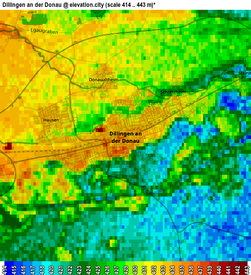
Below is the Elevation map of Dillingen an der Donau, which displays elevation range with different colors. Scale of the first map is from 414 to 443 m (1358 to 1453 ft) with average elevation of 426.7 meters (=1400 ft) [note 1]
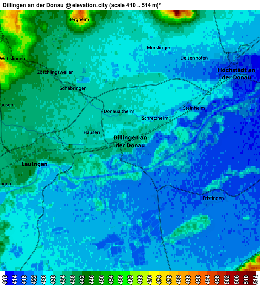
These maps also provides idea of topography and contour of this city, they are displayed at different zoom levels. More info about maps, scale and edge coordinates you can find below images.
| \ | Map #1 | Map #2 | Topo.Map |
| Scale [m] | 414..443 m | 410..514 m | × |
| Scale [ft] | 1358..1453 ft | 1345..1686 ft | × |
| Average | 426.7 m = 1400 ft | 428 m = 1404 ft | × |
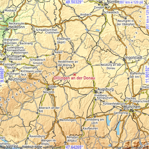
| Width | 6.47 km = 4 mi | 12.93 km = 8 mi | 206.9 km = 128.6 mi |
| Height | 6.47 km = 4 mi | 12.93 km = 8 mi | 206.9 km = 128.6 mi |
| ↑Max Latitude | 48.610594° | 48.639641° | 49.50329° |
| Latitude at center | 48.58153° | 48.58153° | 48.58153° |
| ↓Min Latitude | 48.552449° | 48.523352° | 47.64265° |
| ← Min Longitude | 10.451325° | 10.407379° | 9.08902° |
| Longitude center | 10.49527° | 10.49527° | 10.49527° |
| →Max Longitude | 10.539215° | 10.583161° | 11.90152° |
Nearby cities:
Cities around Dillingen an der Donau sort by population:
• Lauingen elevation 440 m
5.2 km,  253°
253°
• Gundelfingen 439 m
9.6 km, 250°
• Höchstädt an der Donau 418 m
6.3 km,  58°
58°
• Holzheim 431 m
7.9 km,  160°
160°
• Wittislingen 455 m
7.1 km,  306°
306°
• Blindheim 416 m
10.7 km, 58°
• Finningen 457 m
8.1 km,  1°
1°
• Haunsheim 448 m
9.1 km,  282°
282°
• Aislingen 441 m
8.8 km,  198°
198°
• Mödingen 452 m
8.3 km,  325°
325°
• Glött 437 m
9.1 km,  185°
185°
• Ziertheim 462 m
10.6 km,  318°
318°
Multilingual:
 En español:
Dilinga elevación 436 m.
 En France:
Dillingen an der Donau élévation 436 m.
 Auf Deutsch:
Dillingen an der Donau höhe über dem Meeresspiegel ist 436 m.
 На русском:
Диллинген-на-Дунае, Диллинген-ан-дер-Донау высота над уровнем моря 436 м
Sources and notes:
- [note 1] Map square and city borders are not equal. Map elevation data is calculated only from area inside that square.
- [src 1] Elevation data from geonames database provided with same terms of usage.
- [src 2] The elevation map of Dillingen an der Donau is generated using elevation data from NASA's 3 arcsec (90m) resolution SRTM data.
- [src 3] Base (background) map © OpenStreetMap contributors tiles are generated by Geofabrik and OpenTopoMap.
Copyright & License:
This Dillingen an der Donau Elevation Map is licensed under CC BY-SA. You may reuse any part from this page, if you give a proper credit by linking to this URL:
 More info on terms of use page.