Dommershausen elevation
Dommershausen (Rheinland-Pfalz), Germany elevation is 330 meters and Dommershausen elevation in feet is 1083 ft above sea level [src 1]. Dommershausen is a seat of a fourth-order administrative division (feature code) with elevation that is 72 meters (236 ft) bigger than average city elevation in Germany.
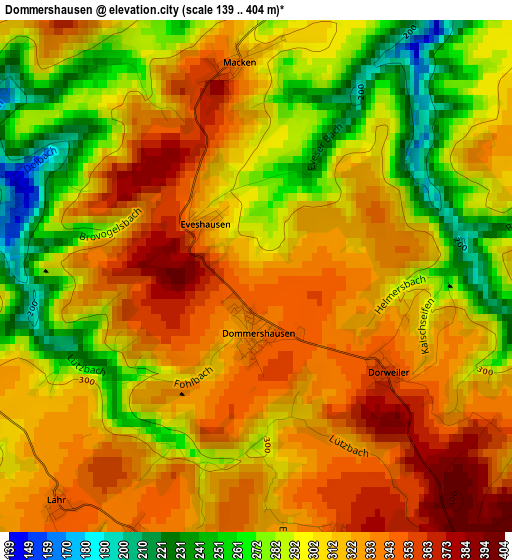
Below is the Elevation map of Dommershausen, which displays elevation range with different colors. Scale of the first map is from 139 to 404 m (456 to 1325 ft) with average elevation of 309.3 meters (=1015 ft) [note 1]
These maps also provides idea of topography and contour of this city, they are displayed at different zoom levels. More info about maps, scale and edge coordinates you can find below images.
| \ | Map #1 | Topo.Map |
| Scale [m] | 139..404 m | × |
| Scale [ft] | 456..1325 ft | × |
| Average | 309.3 m = 1015 ft | × |
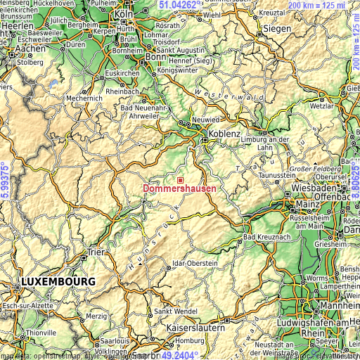
| Width | 6.26 km = 3.9 mi | 200.4 km = 124.5 mi |
| Height | 6.26 km = 3.9 mi | 200.4 km = 124.5 mi |
| ↑Max Latitude | 50.178151° | 51.04262° |
| Latitude at center | 50.15° | 50.15° |
| ↓Min Latitude | 50.121832° | 49.2404° |
| ← Min Longitude | 7.356055° | 5.99375° |
| Longitude center | 7.4° | 7.4° |
| →Max Longitude | 7.443945° | 8.80625° |
Nearby cities:
Cities around Dommershausen sort by population:
• Kastellaun elevation 413 m
9.5 km,  161°
161°
• Emmelshausen 464 m
10.8 km,  87°
87°
• Münstermaifeld 266 m
11.1 km,  345°
345°
• Treis-Karden 102 m
7.4 km,  289°
289°
• Beltheim 429 m
6.6 km,  137°
137°
• Bell 434 m
9.9 km,  173°
173°
• Löf 168 m
9.6 km,  14°
14°
• Gondershausen 400 m
7.1 km, 90°
• Halsenbach 449 m
11.4 km,  77°
77°
• Bruttig-Fankel 96 m
12 km,  261°
261°
• Mastershausen 413 m
9.9 km,  201°
201°
• Nörtershausen 281 m
9.5 km,  38°
38°
Multilingual:
 En español:
Dommershausen elevación 330 m.
 En France:
Dommershausen élévation 330 m.
 Auf Deutsch:
Dommershausen höhe über dem Meeresspiegel ist 330 m.

Sources and notes:
- [note 1] Map square and city borders are not equal. Map elevation data is calculated only from area inside that square.
- [src 1] Elevation data from geonames database provided with same terms of usage.
- [src 2] The elevation map of Dommershausen is generated using elevation data from NASA's 3 arcsec (90m) resolution SRTM data.
- [src 3] Base (background) map © OpenStreetMap contributors tiles are generated by Geofabrik and OpenTopoMap.
Copyright & License:
This Dommershausen Elevation Map is licensed under CC BY-SA. You may reuse any part from this page, if you give a proper credit by linking to this URL:
 More info on terms of use page.