Treis-Karden elevation
Treis-Karden (Rheinland-Pfalz), Germany elevation is 102 meters and Treis-Karden elevation in feet is 335 ft above sea level [src 1]. Treis-Karden is a seat of a fourth-order administrative division (feature code) with elevation that is 156 meters (512 ft) smaller than average city elevation in Germany.
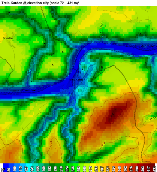
Below is the Elevation map of Treis-Karden, which displays elevation range with different colors. Scale of the first map is from 72 to 431 m (236 to 1414 ft) with average elevation of 233 meters (=764 ft) [note 1]
These maps also provides idea of topography and contour of this city, they are displayed at different zoom levels. More info about maps, scale and edge coordinates you can find below images.
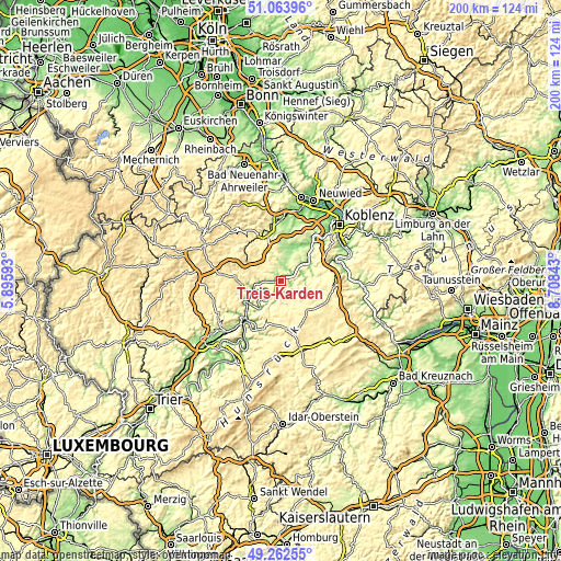
| \ | Map #1 | Topo.Map |
| Scale [m] | 72..431 m | × |
| Scale [ft] | 236..1414 ft | × |
| Average | 233 m = 764 ft | × |
| Width | 6.26 km = 3.9 mi | 200.3 km = 124.5 mi |
| Height | 6.26 km = 3.9 mi | 200.3 km = 124.5 mi |
| ↑Max Latitude | 50.199878° | 51.06396° |
| Latitude at center | 50.17174° | 50.17174° |
| ↓Min Latitude | 50.143585° | 49.26255° |
| ← Min Longitude | 7.258235° | 5.89593° |
| Longitude center | 7.30218° | 7.30218° |
| →Max Longitude | 7.346125° | 8.70843° |
Nearby cities:
Cities around Treis-Karden sort by population:
• Cochem elevation 110 m
10.3 km,  253°
253°
• Münstermaifeld 266 m
9.3 km,  27°
27°
• Kaisersesch 423 m
13.4 km,  299°
299°
• Beltheim 429 m
13.5 km,  122°
122°
• Mertloch 196 m
10.9 km,  2°
2°
• Löf 168 m
11.6 km,  53°
53°
• Klotten 135 m
7.3 km,  265°
265°
• Bruttig-Fankel 96 m
6.5 km,  228°
228°
• Mastershausen 413 m
12.2 km,  163°
163°
• Dommershausen 330 m
7.4 km,  109°
109°
• Faid 391 m
13.4 km,  256°
256°
• Ediger-Eller 344 m
12.5 km,  240°
240°
Multilingual:
 En español:
Treis-Karden elevación 102 m.
 En France:
Treis-Karden élévation 102 m.
 Auf Deutsch:
Treis-Karden höhe über dem Meeresspiegel ist 102 m.

Sources and notes:
- [note 1] Map square and city borders are not equal. Map elevation data is calculated only from area inside that square.
- [src 1] Elevation data from geonames database provided with same terms of usage.
- [src 2] The elevation map of Treis-Karden is generated using elevation data from NASA's 3 arcsec (90m) resolution SRTM data.
- [src 3] Base (background) map © OpenStreetMap contributors tiles are generated by Geofabrik and OpenTopoMap.
Copyright & License:
This Treis-Karden Elevation Map is licensed under CC BY-SA. You may reuse any part from this page, if you give a proper credit by linking to this URL:
 More info on terms of use page.