Egeln elevation
Egeln (Saxony-Anhalt), Germany elevation is 74 meters and Egeln elevation in feet is 243 ft above sea level [src 1]. Egeln is a seat of a fourth-order administrative division (feature code) with elevation that is 184 meters (604 ft) smaller than average city elevation in Germany.
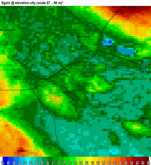
Below is the Elevation map of Egeln, which displays elevation range with different colors. Scale of the first map is from 57 to 96 m (187 to 315 ft) with average elevation of 71.5 meters (=235 ft) [note 1]
These maps also provides idea of topography and contour of this city, they are displayed at different zoom levels. More info about maps, scale and edge coordinates you can find below images.
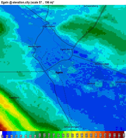
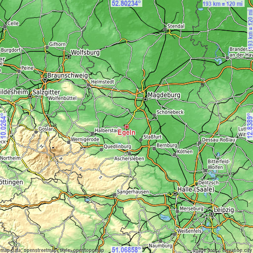
| \ | Map #1 | Map #2 | Topo.Map |
| Scale [m] | 57..96 m | 57..196 m | × |
| Scale [ft] | 187..315 ft | 187..643 ft | × |
| Average | 71.5 m = 235 ft | 81.3 m = 267 ft | × |
| Width | 6.02 km = 3.7 mi | 12.05 km = 7.5 mi | 192.8 km = 119.8 mi |
| Height | 6.02 km = 3.7 mi | 12.05 km = 7.5 mi | 192.8 km = 119.8 mi |
| ↑Max Latitude | 51.970921° | 51.997986° | 52.80234° |
| Latitude at center | 51.94384° | 51.94384° | 51.94384° |
| ↓Min Latitude | 51.916742° | 51.889629° | 51.06858° |
| ← Min Longitude | 11.388705° | 11.344759° | 10.0264° |
| Longitude center | 11.43265° | 11.43265° | 11.43265° |
| →Max Longitude | 11.476595° | 11.520541° | 12.8389° |
Nearby cities:
Cities around Egeln sort by population:
• Wanzleben elevation 97 m
13 km,  2°
2°
• Hecklingen 81 m
12.8 km,  147°
147°
• Westeregeln 74 m
3.5 km,  308°
308°
• Hadmersleben 81 m
10.4 km,  301°
301°
• Groß Börnecke 82 m
7.1 km,  158°
158°
• Kroppenstedt 95 m
8.5 km,  268°
268°
• Atzendorf 84 m
11.7 km,  103°
103°
• Wolmirsleben 79 m
3.5 km,  78°
78°
• Borne 91 m
8.7 km,  86°
86°
• Cochstedt 106 m
7 km,  192°
192°
• Unseburg 70 m
5.6 km, 102°
• Schneidlingen 83 m
5.5 km,  171°
171°
Multilingual:
 En español:
Egeln elevación 74 m.
 En France:
Egeln élévation 74 m.


Sources and notes:
- [note 1] Map square and city borders are not equal. Map elevation data is calculated only from area inside that square.
- [src 1] Elevation data from geonames database provided with same terms of usage.
- [src 2] The elevation map of Egeln is generated using elevation data from NASA's 3 arcsec (90m) resolution SRTM data.
- [src 3] Base (background) map © OpenStreetMap contributors tiles are generated by Geofabrik and OpenTopoMap.
Copyright & License:
This Egeln Elevation Map is licensed under CC BY-SA. You may reuse any part from this page, if you give a proper credit by linking to this URL:
 More info on terms of use page.