Eibau elevation
Eibau (Saxony), Germany elevation is 358 meters and Eibau elevation in feet is 1175 ft above sea level [src 1]. Eibau is a populated place (feature code) with elevation that is 100 meters (328 ft) bigger than average city elevation in Germany.
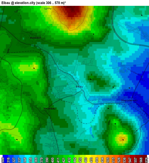
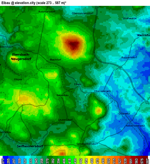
Below is the Elevation map of Eibau, which displays elevation range with different colors. Scale of the first map is from 306 to 578 m (1004 to 1896 ft) with average elevation of 388.9 meters (=1276 ft) [note 1]
These maps also provides idea of topography and contour of this city, they are displayed at different zoom levels. More info about maps, scale and edge coordinates you can find below images.
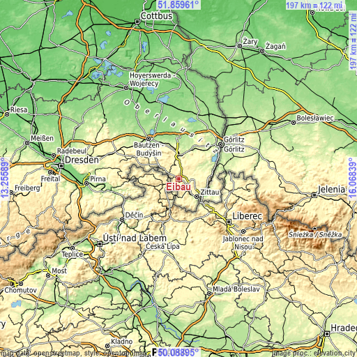
| \ | Map #1 | Map #2 | Topo.Map |
| Scale [m] | 306..578 m | 273..587 m | × |
| Scale [ft] | 1004..1896 ft | 896..1926 ft | × |
| Average | 388.9 m = 1276 ft | 374.6 m = 1229 ft | × |
| Width | 6.15 km = 3.8 mi | 12.3 km = 7.6 mi | 196.9 km = 122.3 mi |
| Height | 6.15 km = 3.8 mi | 12.3 km = 7.6 mi | 196.9 km = 122.3 mi |
| ↑Max Latitude | 51.010378° | 51.038019° | 51.85961° |
| Latitude at center | 50.98272° | 50.98272° | 50.98272° |
| ↓Min Latitude | 50.955046° | 50.927355° | 50.08895° |
| ← Min Longitude | 14.618195° | 14.574249° | 13.25589° |
| Longitude center | 14.66214° | 14.66214° | 14.66214° |
| →Max Longitude | 14.706085° | 14.750031° | 16.06839° |
Nearby cities:
Cities around Eibau sort by population:
• Ebersbach elevation 358 m
6 km,  297°
297°
• Großschönau 322 m
9.3 km,  170°
170°
• Neugersdorf 419 m
3.8 km,  260°
260°
• Seifhennersdorf 354 m
6.8 km,  218°
218°
• Leutersdorf 367 m
3.7 km,  193°
193°
• Herrnhut 342 m
6.8 km,  56°
56°
• Hainewalde 291 m
8.6 km,  160°
160°
• Niedercunnersdorf 287 m
7.9 km,  358°
358°
• Großhennersdorf 307 m
8.8 km,  87°
87°
• Friedersdorf 335 m
8.4 km, 303°
• Großschweidnitz 279 m
9.7 km,  352°
352°
• Dürrhennersdorf 346 m
8.4 km,  330°
330°
Multilingual:
 En español:
Eibau elevación 358 m.
 En France:
Eibau élévation 358 m.


Sources and notes:
- [note 1] Map square and city borders are not equal. Map elevation data is calculated only from area inside that square.
- [src 1] Elevation data from geonames database provided with same terms of usage.
- [src 2] The elevation map of Eibau is generated using elevation data from NASA's 3 arcsec (90m) resolution SRTM data.
- [src 3] Base (background) map © OpenStreetMap contributors tiles are generated by Geofabrik and OpenTopoMap.
Copyright & License:
This Eibau Elevation Map is licensed under CC BY-SA. You may reuse any part from this page, if you give a proper credit by linking to this URL:
 More info on terms of use page.