Eibenstock elevation
Eibenstock (Saxony), Germany elevation is 641 meters and Eibenstock elevation in feet is 2103 ft above sea level [src 1]. Eibenstock is a populated place (feature code) with elevation that is 383 meters (1257 ft) bigger than average city elevation in Germany.
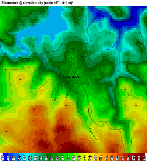
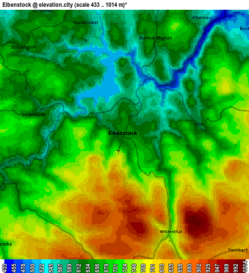
Below is the Elevation map of Eibenstock, which displays elevation range with different colors. Scale of the first map is from 467 to 911 m (1532 to 2989 ft) with average elevation of 660.4 meters (=2167 ft) [note 1]
These maps also provides idea of topography and contour of this city, they are displayed at different zoom levels. More info about maps, scale and edge coordinates you can find below images.
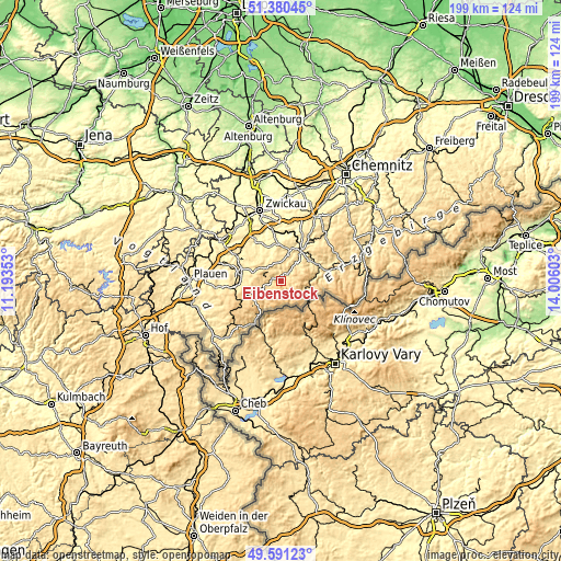
| \ | Map #1 | Map #2 | Topo.Map |
| Scale [m] | 467..911 m | 433..1014 m | × |
| Scale [ft] | 1532..2989 ft | 1421..3327 ft | × |
| Average | 660.4 m = 2167 ft | 697.2 m = 2287 ft | × |
| Width | 6.22 km = 3.9 mi | 12.43 km = 7.7 mi | 198.9 km = 123.6 mi |
| Height | 6.22 km = 3.9 mi | 12.43 km = 7.7 mi | 198.9 km = 123.6 mi |
| ↑Max Latitude | 50.522258° | 50.550189° | 51.38045° |
| Latitude at center | 50.49431° | 50.49431° | 50.49431° |
| ↓Min Latitude | 50.466346° | 50.438365° | 49.59123° |
| ← Min Longitude | 12.555835° | 12.511889° | 11.19353° |
| Longitude center | 12.59978° | 12.59978° | 12.59978° |
| →Max Longitude | 12.643725° | 12.687671° | 14.00603° |
Nearby cities:
Cities around Eibenstock sort by population:
• Aue elevation 399 m
13.1 km,  35°
35°
• Schneeberg 469 m
11.5 km,  14°
14°
• Zschorlau 501 m
8.8 km,  23°
23°
• Johanngeorgenstadt 831 m
10.5 km,  131°
131°
• Bad Schlema 406 m
13.1 km, 23°
• Schönheide 669 m
5.6 km,  281°
281°
• Lauter 465 m
12.2 km,  51°
51°
• Stützengrün 640 m
6.4 km,  312°
312°
• Breitenbrunn 695 m
12 km,  100°
100°
• Bockau 502 m
8.1 km, 49°
• Sosa 609 m
3.7 km,  81°
81°
• Tannenbergsthal 690 m
11.9 km,  237°
237°
Multilingual:
 En español:
Eibenstock elevación 641 m.
 En France:
Eibenstock élévation 641 m.
 Auf Deutsch:
Eibenstock höhe über dem Meeresspiegel ist 641 m.

Sources and notes:
- [note 1] Map square and city borders are not equal. Map elevation data is calculated only from area inside that square.
- [src 1] Elevation data from geonames database provided with same terms of usage.
- [src 2] The elevation map of Eibenstock is generated using elevation data from NASA's 3 arcsec (90m) resolution SRTM data.
- [src 3] Base (background) map © OpenStreetMap contributors tiles are generated by Geofabrik and OpenTopoMap.
Copyright & License:
This Eibenstock Elevation Map is licensed under CC BY-SA. You may reuse any part from this page, if you give a proper credit by linking to this URL:
 More info on terms of use page.