Schönheide elevation
Schönheide (Saxony), Germany elevation is 669 meters and Schönheide elevation in feet is 2195 ft above sea level [src 1]. Schönheide is a populated place (feature code) with elevation that is 411 meters (1348 ft) bigger than average city elevation in Germany.
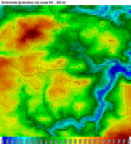
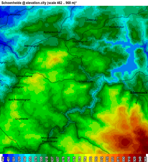
Below is the Elevation map of Schönheide, which displays elevation range with different colors. Scale of the first map is from 541 to 802 m (1775 to 2631 ft) with average elevation of 665.3 meters (=2183 ft) [note 1]
These maps also provides idea of topography and contour of this city, they are displayed at different zoom levels. More info about maps, scale and edge coordinates you can find below images.
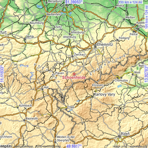
| \ | Map #1 | Map #2 | Topo.Map |
| Scale [m] | 541..802 m | 462..968 m | × |
| Scale [ft] | 1775..2631 ft | 1516..3176 ft | × |
| Average | 665.3 m = 2183 ft | 654.6 m = 2148 ft | × |
| Width | 6.22 km = 3.9 mi | 12.43 km = 7.7 mi | 198.9 km = 123.6 mi |
| Height | 6.22 km = 3.9 mi | 12.43 km = 7.7 mi | 198.9 km = 123.6 mi |
| ↑Max Latitude | 50.532522° | 50.560447° | 51.39053° |
| Latitude at center | 50.50458° | 50.50458° | 50.50458° |
| ↓Min Latitude | 50.476622° | 50.448647° | 49.6017° |
| ← Min Longitude | 12.477635° | 12.433689° | 11.11533° |
| Longitude center | 12.52158° | 12.52158° | 12.52158° |
| →Max Longitude | 12.565525° | 12.609471° | 13.92783° |
Nearby cities:
Cities around Schönheide sort by population:
• Auerbach elevation 458 m
8.6 km,  275°
275°
• Falkenstein 567 m
11 km,  254°
254°
• Rodewisch 434 m
8.2 km,  290°
290°
• Eibenstock 641 m
5.6 km,  101°
101°
• Zschorlau 501 m
11.4 km,  52°
52°
• Stützengrün 640 m
3.3 km,  14°
14°
• Ellefeld 504 m
9.7 km,  256°
256°
• Bockau 502 m
12.4 km,  70°
70°
• Sosa 609 m
9.2 km,  93°
93°
• Grünbach 697 m
12.8 km,  241°
241°
• Tannenbergsthal 690 m
8.8 km,  210°
210°
• Hammerbrücke 675 m
10.8 km,  224°
224°
Multilingual:
 En español:
Schönheide elevación 669 m.
 En France:
Schönheide élévation 669 m.
 Auf Deutsch:
Schönheide höhe über dem Meeresspiegel ist 669 m.

Sources and notes:
- [note 1] Map square and city borders are not equal. Map elevation data is calculated only from area inside that square.
- [src 1] Elevation data from geonames database provided with same terms of usage.
- [src 2] The elevation map of Schönheide is generated using elevation data from NASA's 3 arcsec (90m) resolution SRTM data.
- [src 3] Base (background) map © OpenStreetMap contributors tiles are generated by Geofabrik and OpenTopoMap.
Copyright & License:
This Schönheide Elevation Map is licensed under CC BY-SA. You may reuse any part from this page, if you give a proper credit by linking to this URL:
 More info on terms of use page.