Ennigerloh elevation
Ennigerloh (North Rhine-Westphalia, Regierungsbezirk Münster), Germany elevation is 104 meters and Ennigerloh elevation in feet is 341 ft above sea level [src 1]. Ennigerloh is a populated place (feature code) with elevation that is 154 meters (505 ft) smaller than average city elevation in Germany.
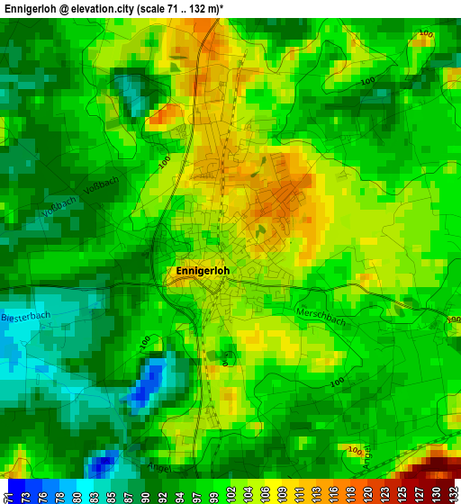
Below is the Elevation map of Ennigerloh, which displays elevation range with different colors. Scale of the first map is from 71 to 132 m (233 to 433 ft) with average elevation of 98.5 meters (=323 ft) [note 1]
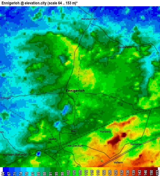
These maps also provides idea of topography and contour of this city, they are displayed at different zoom levels. More info about maps, scale and edge coordinates you can find below images.
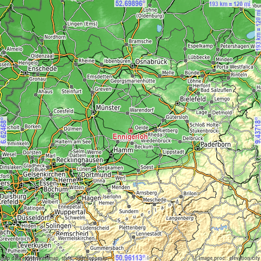
| \ | Map #1 | Map #2 | Topo.Map |
| Scale [m] | 71..132 m | 64..153 m | × |
| Scale [ft] | 233..433 ft | 210..502 ft | × |
| Average | 98.5 m = 323 ft | 93.8 m = 308 ft | × |
| Width | 6.04 km = 3.8 mi | 12.08 km = 7.5 mi | 193.2 km = 120 mi |
| Height | 6.04 km = 3.8 mi | 12.08 km = 7.5 mi | 193.2 km = 120 mi |
| ↑Max Latitude | 51.865575° | 51.892703° | 52.69896° |
| Latitude at center | 51.83843° | 51.83843° | 51.83843° |
| ↓Min Latitude | 51.811269° | 51.784091° | 50.96113° |
| ← Min Longitude | 7.986985° | 7.943039° | 6.62468° |
| Longitude center | 8.03093° | 8.03093° | 8.03093° |
| →Max Longitude | 8.074875° | 8.118821° | 9.43718° |
Nearby cities:
Cities around Ennigerloh sort by population:
• Ahlen elevation 82 m
12.9 km,  229°
229°
• Rheda-Wiedenbrück 72 m
18.5 km,  86°
86°
• Warendorf 58 m
12.9 km,  346°
346°
• Beckum 116 m
9.2 km,  175°
175°
• Oelde 90 m
8.1 km,  97°
97°
• Harsewinkel 65 m
19.3 km,  44°
44°
• Drensteinfurt 64 m
20.7 km,  256°
256°
• Sassenberg 61 m
17.1 km,  2°
2°
• Sendenhorst 69 m
13.8 km,  272°
272°
• Wadersloh 95 m
19.1 km,  127°
127°
• Everswinkel 72 m
15.9 km,  307°
307°
• Beelen 60 m
11.5 km,  28°
28°
Multilingual:
 En español:
Ennigerloh elevación 104 m.
 En France:
Ennigerloh élévation 104 m.
 Auf Deutsch:
Ennigerloh höhe über dem Meeresspiegel ist 104 m.

Sources and notes:
- [note 1] Map square and city borders are not equal. Map elevation data is calculated only from area inside that square.
- [src 1] Elevation data from geonames database provided with same terms of usage.
- [src 2] The elevation map of Ennigerloh is generated using elevation data from NASA's 3 arcsec (90m) resolution SRTM data.
- [src 3] Base (background) map © OpenStreetMap contributors tiles are generated by Geofabrik and OpenTopoMap.
Copyright & License:
This Ennigerloh Elevation Map is licensed under CC BY-SA. You may reuse any part from this page, if you give a proper credit by linking to this URL:
 More info on terms of use page.