Esthal elevation
Esthal (Rheinland-Pfalz), Germany elevation is 453 meters and Esthal elevation in feet is 1486 ft above sea level [src 1]. Esthal is a seat of a fourth-order administrative division (feature code) with elevation that is 195 meters (640 ft) bigger than average city elevation in Germany.
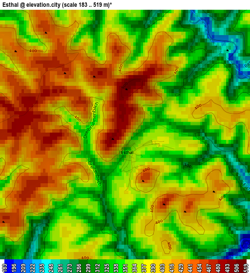
Below is the Elevation map of Esthal, which displays elevation range with different colors. Scale of the first map is from 183 to 519 m (600 to 1703 ft) with average elevation of 376.9 meters (=1237 ft) [note 1]
These maps also provides idea of topography and contour of this city, they are displayed at different zoom levels. More info about maps, scale and edge coordinates you can find below images.
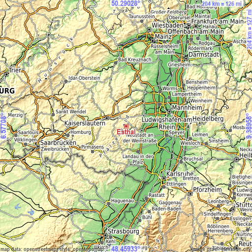
| \ | Map #1 | Topo.Map |
| Scale [m] | 183..519 m | × |
| Scale [ft] | 600..1703 ft | × |
| Average | 376.9 m = 1237 ft | × |
| Width | 6.36 km = 4 mi | 203.6 km = 126.5 mi |
| Height | 6.36 km = 4 mi | 203.6 km = 126.5 mi |
| ↑Max Latitude | 49.41193° | 50.29028° |
| Latitude at center | 49.38333° | 49.38333° |
| ↓Min Latitude | 49.354713° | 48.45933° |
| ← Min Longitude | 7.939385° | 6.57708° |
| Longitude center | 7.98333° | 7.98333° |
| →Max Longitude | 8.027275° | 9.38958° |
Nearby cities:
Cities around Esthal sort by population:
• Neustadt elevation 144 m
11.9 km,  108°
108°
• Enkenbach-Alsenborn 298 m
12.6 km,  331°
331°
• Hochspeyer 267 m
9.1 km,  315°
315°
• Maikammer 177 m
13.8 km,  128°
128°
• Lambrecht 168 m
6.6 km,  102°
102°
• Carlsberg 330 m
14.1 km,  17°
17°
• Elmstein 390 m
4.1 km,  242°
242°
• Weidenthal 213 m
3.9 km, 18°
• Sankt Martin 228 m
12.8 km,  136°
136°
• Lindenberg 214 m
8.4 km,  92°
92°
• Frankenstein 283 m
6.3 km,  356°
356°
• Ramberg 235 m
13.8 km,  172°
172°
Multilingual:
 En español:
Esthal elevación 453 m.
 En France:
Esthal élévation 453 m.


Sources and notes:
- [note 1] Map square and city borders are not equal. Map elevation data is calculated only from area inside that square.
- [src 1] Elevation data from geonames database provided with same terms of usage.
- [src 2] The elevation map of Esthal is generated using elevation data from NASA's 3 arcsec (90m) resolution SRTM data.
- [src 3] Base (background) map © OpenStreetMap contributors tiles are generated by Geofabrik and OpenTopoMap.
Copyright & License:
This Esthal Elevation Map is licensed under CC BY-SA. You may reuse any part from this page, if you give a proper credit by linking to this URL:
 More info on terms of use page.