Lambrecht elevation
Lambrecht (Rheinland-Pfalz), Germany elevation is 168 meters and Lambrecht elevation in feet is 551 ft above sea level [src 1]. Lambrecht is a populated place (feature code) with elevation that is 90 meters (295 ft) smaller than average city elevation in Germany.
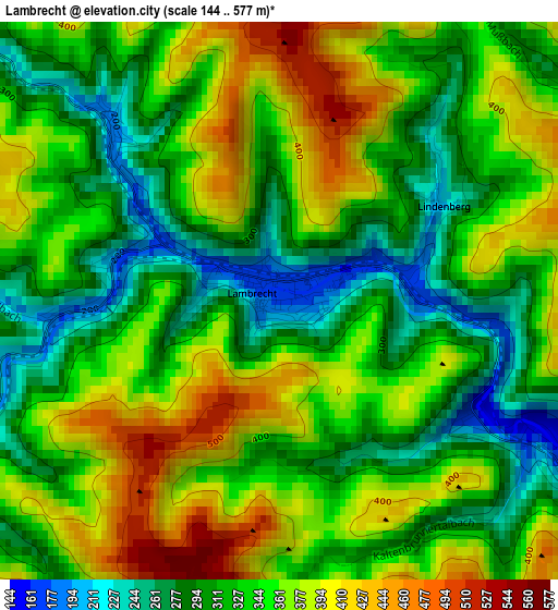
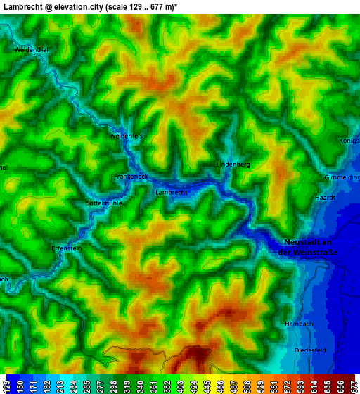
Below is the Elevation map of Lambrecht, which displays elevation range with different colors. Scale of the first map is from 144 to 577 m (472 to 1893 ft) with average elevation of 340.5 meters (=1117 ft) [note 1]
These maps also provides idea of topography and contour of this city, they are displayed at different zoom levels. More info about maps, scale and edge coordinates you can find below images.
| \ | Map #1 | Map #2 | Topo.Map |
| Scale [m] | 144..577 m | 129..677 m | × |
| Scale [ft] | 472..1893 ft | 423..2221 ft | × |
| Average | 340.5 m = 1117 ft | 353.8 m = 1161 ft | × |
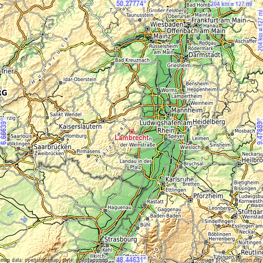
| Width | 6.36 km = 4 mi | 12.73 km = 7.9 mi | 203.6 km = 126.5 mi |
| Height | 6.36 km = 4 mi | 12.73 km = 7.9 mi | 203.6 km = 126.5 mi |
| ↑Max Latitude | 49.399157° | 49.427748° | 50.27774° |
| Latitude at center | 49.37055° | 49.37055° | 49.37055° |
| ↓Min Latitude | 49.341926° | 49.313285° | 48.44631° |
| ← Min Longitude | 8.028695° | 7.984749° | 6.66639° |
| Longitude center | 8.07264° | 8.07264° | 8.07264° |
| →Max Longitude | 8.116585° | 8.160531° | 9.47889° |
Nearby cities:
Cities around Lambrecht sort by population:
• Neustadt elevation 144 m
5.3 km,  115°
115°
• Edenkoben 171 m
10.4 km,  157°
157°
• Lachen-Speyerdorf 120 m
10.2 km, 115°
• Maikammer 177 m
8.4 km,  149°
149°
• Deidesheim 124 m
9.1 km,  62°
62°
• Elmstein 390 m
10.1 km,  267°
267°
• Kirrweiler 139 m
10.1 km,  139°
139°
• Weidenthal 213 m
7.3 km,  314°
314°
• Sankt Martin 228 m
8.2 km, 163°
• Esthal 453 m
6.6 km,  282°
282°
• Ruppertsberg 123 m
9.5 km,  69°
69°
• Lindenberg 214 m
2.2 km, 60°
Multilingual:
 En español:
Lambrecht elevación 168 m.
 En France:
Lambrecht élévation 168 m.
 Auf Deutsch:
Lambrecht höhe über dem Meeresspiegel ist 168 m.

Sources and notes:
- [note 1] Map square and city borders are not equal. Map elevation data is calculated only from area inside that square.
- [src 1] Elevation data from geonames database provided with same terms of usage.
- [src 2] The elevation map of Lambrecht is generated using elevation data from NASA's 3 arcsec (90m) resolution SRTM data.
- [src 3] Base (background) map © OpenStreetMap contributors tiles are generated by Geofabrik and OpenTopoMap.
Copyright & License:
This Lambrecht Elevation Map is licensed under CC BY-SA. You may reuse any part from this page, if you give a proper credit by linking to this URL:
 More info on terms of use page.