Flammersfeld elevation
Flammersfeld (Rheinland-Pfalz), Germany elevation is 270 meters and Flammersfeld elevation in feet is 886 ft above sea level [src 1]. Flammersfeld is a seat of a fourth-order administrative division (feature code) with elevation that is 12 meters (39 ft) bigger than average city elevation in Germany.
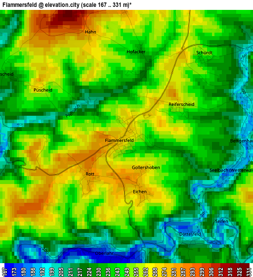
Below is the Elevation map of Flammersfeld, which displays elevation range with different colors. Scale of the first map is from 167 to 331 m (548 to 1086 ft) with average elevation of 241.7 meters (=793 ft) [note 1]
These maps also provides idea of topography and contour of this city, they are displayed at different zoom levels. More info about maps, scale and edge coordinates you can find below images.
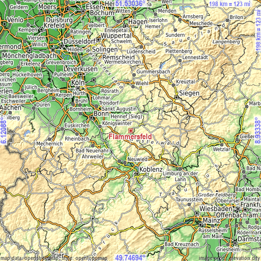
| \ | Map #1 | Topo.Map |
| Scale [m] | 167..331 m | × |
| Scale [ft] | 548..1086 ft | × |
| Average | 241.7 m = 793 ft | × |
| Width | 6.2 km = 3.9 mi | 198.3 km = 123.2 mi |
| Height | 6.2 km = 3.9 mi | 198.3 km = 123.2 mi |
| ↑Max Latitude | 50.674967° | 51.53036° |
| Latitude at center | 50.64711° | 50.64711° |
| ↓Min Latitude | 50.619236° | 49.74694° |
| ← Min Longitude | 7.483185° | 6.12088° |
| Longitude center | 7.52713° | 7.52713° |
| →Max Longitude | 7.571075° | 8.93338° |
Nearby cities:
Cities around Flammersfeld sort by population:
• Asbach elevation 249 m
8.1 km,  285°
285°
• Altenkirchen 217 m
9.2 km,  61°
61°
• Windhagen 315 m
12.3 km,  266°
266°
• Sankt Katharinen 298 m
12.4 km,  235°
235°
• Puderbach 238 m
8.2 km,  129°
129°
• Raubach 224 m
10.6 km,  139°
139°
• Horhausen 337 m
6.6 km,  178°
178°
• Urbach-Überdorf 309 m
10.9 km,  157°
157°
• Weyerbusch 294 m
7.9 km,  11°
11°
• Steimel 304 m
8.2 km,  114°
114°
• Mammelzen 236 m
11.5 km, 59°
• Dernbach 322 m
12 km,  154°
154°
Multilingual:
 En español:
Flammersfeld elevación 270 m.
 En France:
Flammersfeld élévation 270 m.
 Auf Deutsch:
Flammersfeld höhe über dem Meeresspiegel ist 270 m.

Sources and notes:
- [note 1] Map square and city borders are not equal. Map elevation data is calculated only from area inside that square.
- [src 1] Elevation data from geonames database provided with same terms of usage.
- [src 2] The elevation map of Flammersfeld is generated using elevation data from NASA's 3 arcsec (90m) resolution SRTM data.
- [src 3] Base (background) map © OpenStreetMap contributors tiles are generated by Geofabrik and OpenTopoMap.
Copyright & License:
This Flammersfeld Elevation Map is licensed under CC BY-SA. You may reuse any part from this page, if you give a proper credit by linking to this URL:
 More info on terms of use page.