Friedrichroda elevation
Friedrichroda (Thuringia), Germany elevation is 428 meters and Friedrichroda elevation in feet is 1404 ft above sea level [src 1]. Friedrichroda is a populated place (feature code) with elevation that is 170 meters (558 ft) bigger than average city elevation in Germany.
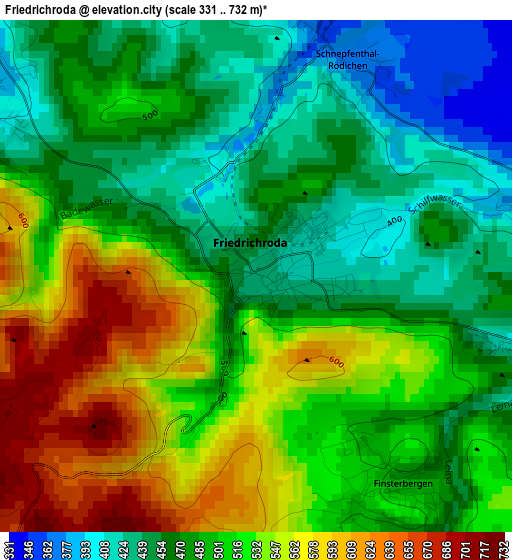
Below is the Elevation map of Friedrichroda, which displays elevation range with different colors. Scale of the first map is from 331 to 732 m (1086 to 2402 ft) with average elevation of 499.5 meters (=1639 ft) [note 1]
These maps also provides idea of topography and contour of this city, they are displayed at different zoom levels. More info about maps, scale and edge coordinates you can find below images.
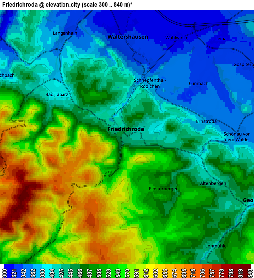
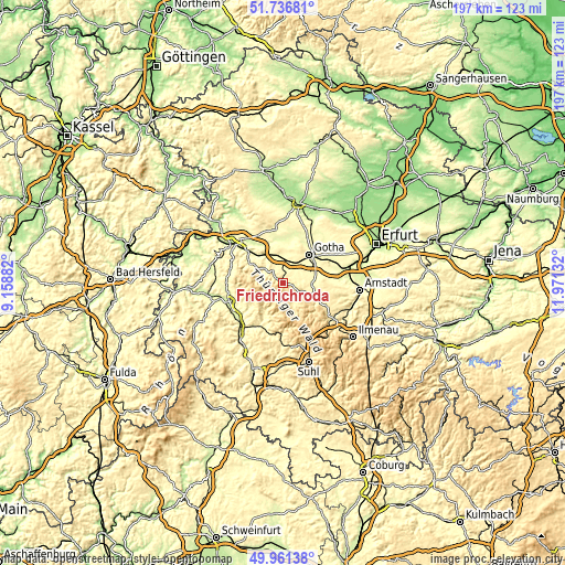
| \ | Map #1 | Map #2 | Topo.Map |
| Scale [m] | 331..732 m | 300..840 m | × |
| Scale [ft] | 1086..2402 ft | 984..2756 ft | × |
| Average | 499.5 m = 1639 ft | 481 m = 1578 ft | × |
| Width | 6.17 km = 3.8 mi | 12.34 km = 7.7 mi | 197.4 km = 122.7 mi |
| Height | 6.17 km = 3.8 mi | 12.34 km = 7.7 mi | 197.4 km = 122.7 mi |
| ↑Max Latitude | 50.885272° | 50.912988° | 51.73681° |
| Latitude at center | 50.85754° | 50.85754° | 50.85754° |
| ↓Min Latitude | 50.829791° | 50.802026° | 49.96138° |
| ← Min Longitude | 10.521125° | 10.477179° | 9.15882° |
| Longitude center | 10.56507° | 10.56507° | 10.56507° |
| →Max Longitude | 10.609015° | 10.652961° | 11.97132° |
Nearby cities:
Cities around Friedrichroda sort by population:
• Waltershausen elevation 330 m
4.6 km,  353°
353°
• Tambach-Dietharz 458 m
8.1 km,  153°
153°
• Trusetal 406 m
13.3 km,  231°
231°
• Tabarz 400 m
4 km,  299°
299°
• Brotterode 564 m
9.2 km,  246°
246°
• Georgenthal 383 m
7.4 km,  112°
112°
• Pappenheim 457 m
9.3 km,  222°
222°
• Gräfenhain 418 m
10.5 km,  115°
115°
• Finsterbergen 481 m
3.1 km, 146°
• Hörselgau 301 m
7.1 km,  11°
11°
• Mechterstädt 276 m
9.8 km,  342°
342°
• Ernstroda 361 m
4 km,  78°
78°
Multilingual:
 En español:
Friedrichroda elevación 428 m.
 En France:
Friedrichroda élévation 428 m.
 Auf Deutsch:
Friedrichroda höhe über dem Meeresspiegel ist 428 m.

Sources and notes:
- [note 1] Map square and city borders are not equal. Map elevation data is calculated only from area inside that square.
- [src 1] Elevation data from geonames database provided with same terms of usage.
- [src 2] The elevation map of Friedrichroda is generated using elevation data from NASA's 3 arcsec (90m) resolution SRTM data.
- [src 3] Base (background) map © OpenStreetMap contributors tiles are generated by Geofabrik and OpenTopoMap.
Copyright & License:
This Friedrichroda Elevation Map is licensed under CC BY-SA. You may reuse any part from this page, if you give a proper credit by linking to this URL:
 More info on terms of use page.