Trusetal elevation
Trusetal (Thuringia), Germany elevation is 406 meters and Trusetal elevation in feet is 1332 ft above sea level [src 1]. Trusetal is a seat of a fourth-order administrative division (feature code) with elevation that is 148 meters (486 ft) bigger than average city elevation in Germany.
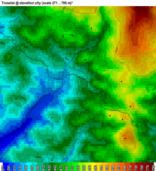
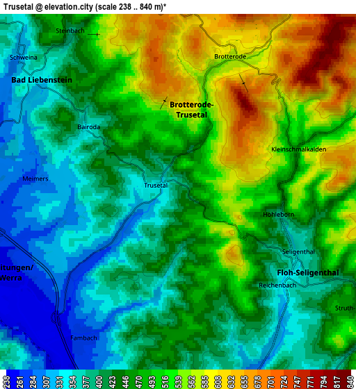
Below is the Elevation map of Trusetal, which displays elevation range with different colors. Scale of the first map is from 271 to 795 m (889 to 2608 ft) with average elevation of 463.9 meters (=1522 ft) [note 1]
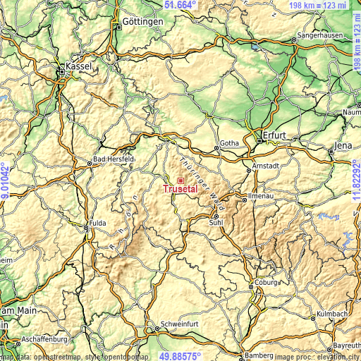
These maps also provides idea of topography and contour of this city, they are displayed at different zoom levels. More info about maps, scale and edge coordinates you can find below images.
| \ | Map #1 | Map #2 | Topo.Map |
| Scale [m] | 271..795 m | 238..840 m | × |
| Scale [ft] | 889..2608 ft | 781..2756 ft | × |
| Average | 463.9 m = 1522 ft | 454.8 m = 1492 ft | × |
| Width | 6.18 km = 3.8 mi | 12.36 km = 7.7 mi | 197.7 km = 122.8 mi |
| Height | 6.18 km = 3.8 mi | 12.36 km = 7.7 mi | 197.7 km = 122.8 mi |
| ↑Max Latitude | 50.811106° | 50.838866° | 51.664° |
| Latitude at center | 50.78333° | 50.78333° | 50.78333° |
| ↓Min Latitude | 50.755537° | 50.727728° | 49.88575° |
| ← Min Longitude | 10.372725° | 10.328779° | 9.01042° |
| Longitude center | 10.41667° | 10.41667° | 10.41667° |
| →Max Longitude | 10.460615° | 10.504561° | 11.82292° |
Nearby cities:
Cities around Trusetal sort by population:
• Schmalkalden elevation 291 m
7.2 km,  164°
164°
• Breitungen 252 m
6.7 km,  250°
250°
• Bad Liebenstein 326 m
5.8 km,  308°
308°
• Wernshausen 263 m
8.1 km,  215°
215°
• Schweina 306 m
7.2 km, 309°
• Brotterode 564 m
4.9 km,  23°
23°
• Schwallungen 274 m
10.9 km,  202°
202°
• Fambach 266 m
6.6 km,  212°
212°
• Immelborn 252 m
9.8 km,  275°
275°
• Pappenheim 457 m
4.3 km,  70°
70°
• Steinbach 394 m
6.7 km,  326°
326°
• Breitenbach 366 m
11.7 km,  153°
153°
Multilingual:
 En español:
Trusetal elevación 406 m.
 En France:
Trusetal élévation 406 m.
 Auf Deutsch:
Trusetal höhe über dem Meeresspiegel ist 406 m.

Sources and notes:
- [note 1] Map square and city borders are not equal. Map elevation data is calculated only from area inside that square.
- [src 1] Elevation data from geonames database provided with same terms of usage.
- [src 2] The elevation map of Trusetal is generated using elevation data from NASA's 3 arcsec (90m) resolution SRTM data.
- [src 3] Base (background) map © OpenStreetMap contributors tiles are generated by Geofabrik and OpenTopoMap.
Copyright & License:
This Trusetal Elevation Map is licensed under CC BY-SA. You may reuse any part from this page, if you give a proper credit by linking to this URL:
 More info on terms of use page.