Friesenhagen elevation
Friesenhagen (Rheinland-Pfalz), Germany elevation is 297 meters and Friesenhagen elevation in feet is 974 ft above sea level [src 1]. Friesenhagen is a seat of a fourth-order administrative division (feature code) with elevation that is 39 meters (128 ft) bigger than average city elevation in Germany.
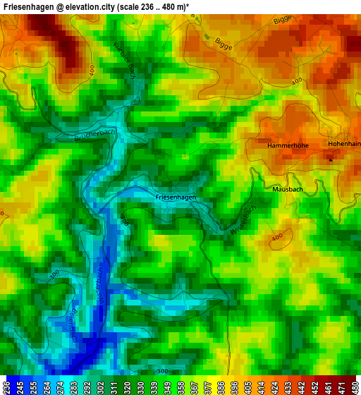
Below is the Elevation map of Friesenhagen, which displays elevation range with different colors. Scale of the first map is from 236 to 480 m (774 to 1575 ft) with average elevation of 351.7 meters (=1154 ft) [note 1]
These maps also provides idea of topography and contour of this city, they are displayed at different zoom levels. More info about maps, scale and edge coordinates you can find below images.
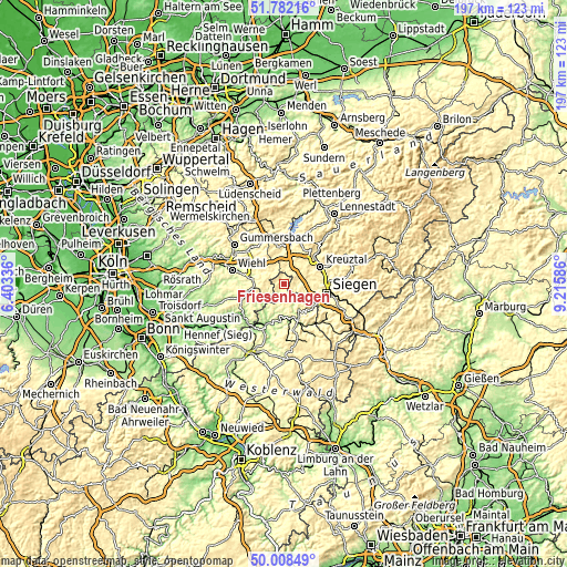
| \ | Map #1 | Topo.Map |
| Scale [m] | 236..480 m | × |
| Scale [ft] | 774..1575 ft | × |
| Average | 351.7 m = 1154 ft | × |
| Width | 6.16 km = 3.8 mi | 197.2 km = 122.5 mi |
| Height | 6.16 km = 3.8 mi | 197.2 km = 122.5 mi |
| ↑Max Latitude | 50.931475° | 51.78216° |
| Latitude at center | 50.90377° | 50.90377° |
| ↓Min Latitude | 50.876049° | 50.00849° |
| ← Min Longitude | 7.765665° | 6.40336° |
| Longitude center | 7.80961° | 7.80961° |
| →Max Longitude | 7.853555° | 9.21586° |
Nearby cities:
Cities around Friesenhagen sort by population:
• Wenden elevation 405 m
8.1 km,  29°
29°
• Freudenberg 297 m
4.6 km,  98°
98°
• Morsbach 218 m
7.1 km,  234°
234°
• Betzdorf 189 m
13.3 km,  160°
160°
• Kirchen 260 m
11.9 km,  153°
153°
• Mudersbach 248 m
12.8 km,  132°
132°
• Niederfischbach 296 m
7.2 km, 146°
• Birken-Honigsessen 237 m
11.1 km,  208°
208°
• Brachbach 224 m
13 km,  138°
138°
• Scheuerfeld 200 m
13.1 km,  170°
170°
• Katzwinkel 281 m
9.9 km, 174°
• Wallmenroth 275 m
11.7 km, 171°
Multilingual:
 En español:
Friesenhagen elevación 297 m.
 En France:
Friesenhagen élévation 297 m.
 Auf Deutsch:
Friesenhagen höhe über dem Meeresspiegel ist 297 m.

Sources and notes:
- [note 1] Map square and city borders are not equal. Map elevation data is calculated only from area inside that square.
- [src 1] Elevation data from geonames database provided with same terms of usage.
- [src 2] The elevation map of Friesenhagen is generated using elevation data from NASA's 3 arcsec (90m) resolution SRTM data.
- [src 3] Base (background) map © OpenStreetMap contributors tiles are generated by Geofabrik and OpenTopoMap.
Copyright & License:
This Friesenhagen Elevation Map is licensed under CC BY-SA. You may reuse any part from this page, if you give a proper credit by linking to this URL:
 More info on terms of use page.