Scheuerfeld elevation
Scheuerfeld (Rheinland-Pfalz), Germany elevation is 200 meters and Scheuerfeld elevation in feet is 656 ft above sea level [src 1]. Scheuerfeld is a seat of a fourth-order administrative division (feature code) with elevation that is 58 meters (190 ft) smaller than average city elevation in Germany.
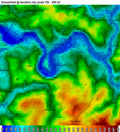
Below is the Elevation map of Scheuerfeld, which displays elevation range with different colors. Scale of the first map is from 159 to 459 m (522 to 1506 ft) with average elevation of 270.6 meters (=888 ft) [note 1]
These maps also provides idea of topography and contour of this city, they are displayed at different zoom levels. More info about maps, scale and edge coordinates you can find below images.
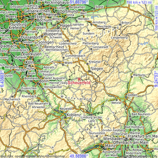
| \ | Map #1 | Topo.Map |
| Scale [m] | 159..459 m | × |
| Scale [ft] | 522..1506 ft | × |
| Average | 270.6 m = 888 ft | × |
| Width | 6.18 km = 3.8 mi | 197.7 km = 122.8 mi |
| Height | 6.18 km = 3.8 mi | 197.7 km = 122.8 mi |
| ↑Max Latitude | 50.815134° | 51.66796° |
| Latitude at center | 50.78736° | 50.78736° |
| ↓Min Latitude | 50.75957° | 49.88986° |
| ← Min Longitude | 7.797335° | 6.43503° |
| Longitude center | 7.84128° | 7.84128° |
| →Max Longitude | 7.885225° | 9.24753° |
Nearby cities:
Cities around Scheuerfeld sort by population:
• Betzdorf elevation 189 m
2.2 km,  79°
79°
• Kirchen 260 m
3.9 km,  53°
53°
• Wissen 193 m
7.6 km,  263°
263°
• Niederfischbach 296 m
7.2 km,  14°
14°
• Brachbach 224 m
7.2 km,  63°
63°
• Katzwinkel 281 m
3.3 km,  336°
336°
• Elkenroth 459 m
6.7 km,  153°
153°
• Gebhardshain 377 m
4.5 km,  202°
202°
• Alsdorf 196 m
3.3 km,  109°
109°
• Wallmenroth 275 m
1.5 km, 338°
• Mittelhof 254 m
2.9 km,  242°
242°
• Niederdreisbach 294 m
7.1 km,  126°
126°
Multilingual:
 En español:
Scheuerfeld elevación 200 m.
 En France:
Scheuerfeld élévation 200 m.
 Auf Deutsch:
Scheuerfeld höhe über dem Meeresspiegel ist 200 m.

Sources and notes:
- [note 1] Map square and city borders are not equal. Map elevation data is calculated only from area inside that square.
- [src 1] Elevation data from geonames database provided with same terms of usage.
- [src 2] The elevation map of Scheuerfeld is generated using elevation data from NASA's 3 arcsec (90m) resolution SRTM data.
- [src 3] Base (background) map © OpenStreetMap contributors tiles are generated by Geofabrik and OpenTopoMap.
Copyright & License:
This Scheuerfeld Elevation Map is licensed under CC BY-SA. You may reuse any part from this page, if you give a proper credit by linking to this URL:
 More info on terms of use page.