Furth im Wald elevation
Furth im Wald (Bavaria, Upper Palatinate), Germany elevation is 403 meters and Furth im Wald elevation in feet is 1322 ft above sea level [src 1]. Furth im Wald is a populated place (feature code) with elevation that is 145 meters (476 ft) bigger than average city elevation in Germany.
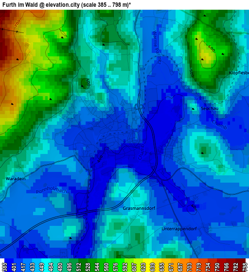
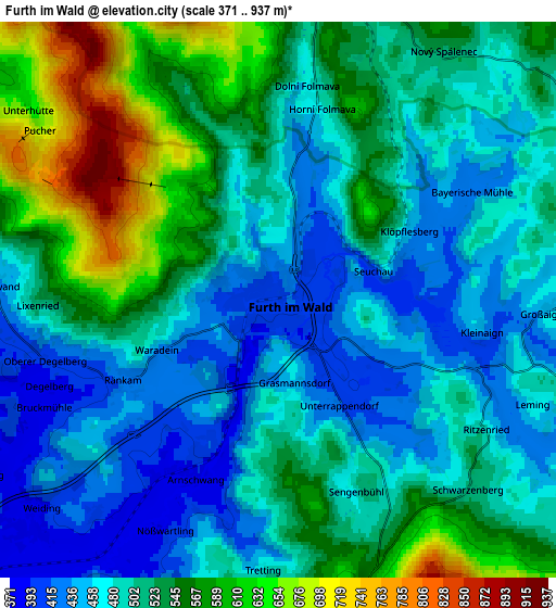
Below is the Elevation map of Furth im Wald, which displays elevation range with different colors. Scale of the first map is from 385 to 798 m (1263 to 2618 ft) with average elevation of 463.4 meters (=1520 ft) [note 1]
These maps also provides idea of topography and contour of this city, they are displayed at different zoom levels. More info about maps, scale and edge coordinates you can find below images.
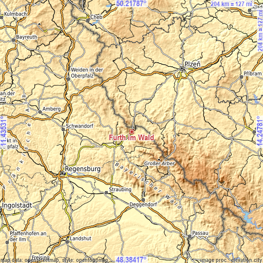
| \ | Map #1 | Map #2 | Topo.Map |
| Scale [m] | 385..798 m | 371..937 m | × |
| Scale [ft] | 1263..2618 ft | 1217..3074 ft | × |
| Average | 463.4 m = 1520 ft | 509.8 m = 1673 ft | × |
| Width | 6.37 km = 4 mi | 12.74 km = 7.9 mi | 203.9 km = 126.7 mi |
| Height | 6.37 km = 4 mi | 12.74 km = 7.9 mi | 203.9 km = 126.7 mi |
| ↑Max Latitude | 49.338193° | 49.366819° | 50.21787° |
| Latitude at center | 49.30955° | 49.30955° | 49.30955° |
| ↓Min Latitude | 49.280891° | 49.252214° | 48.38417° |
| ← Min Longitude | 12.797615° | 12.753669° | 11.43531° |
| Longitude center | 12.84156° | 12.84156° | 12.84156° |
| →Max Longitude | 12.885505° | 12.929451° | 14.24781° |
Nearby cities:
Cities around Furth im Wald sort by population:
• Waldmünchen elevation 526 m
12.3 km,  308°
308°
• Neukirchen 495 m
10.8 km,  120°
120°
• Eschlkam 462 m
5.5 km,  102°
102°
• Chamerau 373 m
13.9 km,  208°
208°
• Weiding 380 m
7.7 km,  227°
227°
• Runding 478 m
12 km, 208°
• Willmering 392 m
14.3 km,  242°
242°
• Hohenwarth 532 m
13.9 km,  151°
151°
• Arnschwang 399 m
4.1 km, 206°
• Rimbach 587 m
9 km,  160°
160°
• Waffenbrunn 421 m
13.6 km,  249°
249°
• Grafenwiesen 443 m
12.6 km,  166°
166°
Multilingual:
 En español:
Furth im Wald elevación 403 m.
 En France:
Furth im Wald élévation 403 m.
 Auf Deutsch:
Furth im Wald höhe über dem Meeresspiegel ist 403 m.

Sources and notes:
- [note 1] Map square and city borders are not equal. Map elevation data is calculated only from area inside that square.
- [src 1] Elevation data from geonames database provided with same terms of usage.
- [src 2] The elevation map of Furth im Wald is generated using elevation data from NASA's 3 arcsec (90m) resolution SRTM data.
- [src 3] Base (background) map © OpenStreetMap contributors tiles are generated by Geofabrik and OpenTopoMap.
Copyright & License:
This Furth im Wald Elevation Map is licensed under CC BY-SA. You may reuse any part from this page, if you give a proper credit by linking to this URL:
 More info on terms of use page.