Gaiberg elevation
Gaiberg (Baden-Württemberg, Karlsruhe Region), Germany elevation is 291 meters and Gaiberg elevation in feet is 955 ft above sea level [src 1]. Gaiberg is a seat of a fourth-order administrative division (feature code) with elevation that is 33 meters (108 ft) bigger than average city elevation in Germany.
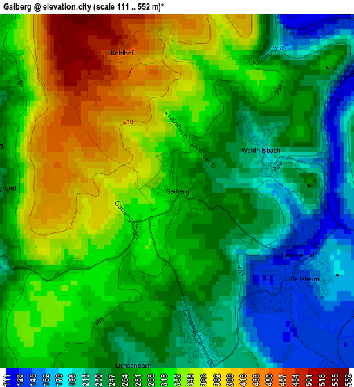
Below is the Elevation map of Gaiberg, which displays elevation range with different colors. Scale of the first map is from 111 to 552 m (364 to 1811 ft) with average elevation of 291.7 meters (=957 ft) [note 1]
These maps also provides idea of topography and contour of this city, they are displayed at different zoom levels. More info about maps, scale and edge coordinates you can find below images.
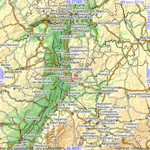
| \ | Map #1 | Topo.Map |
| Scale [m] | 111..552 m | × |
| Scale [ft] | 364..1811 ft | × |
| Average | 291.7 m = 957 ft | × |
| Width | 6.36 km = 4 mi | 203.7 km = 126.6 mi |
| Height | 6.36 km = 4 mi | 203.6 km = 126.5 mi |
| ↑Max Latitude | 49.395° | 50.27365° |
| Latitude at center | 49.36639° | 49.36639° |
| ↓Min Latitude | 49.337764° | 48.44207° |
| ← Min Longitude | 8.705775° | 7.34347° |
| Longitude center | 8.74972° | 8.74972° |
| →Max Longitude | 8.793665° | 10.15597° |
Nearby cities:
Cities around Gaiberg sort by population:
• Heidelberg elevation 115 m
6.3 km,  317°
317°
• Leimen 112 m
5 km,  244°
244°
• Wiesloch 134 m
8.8 km,  205°
205°
• Sandhausen 109 m
7.1 km,  248°
248°
• Neckargemünd 122 m
4.2 km,  53°
53°
• Nußloch 149 m
6.1 km,  219°
219°
• Bammental 128 m
2.4 km,  117°
117°
• Meckesheim 144 m
7.1 km,  134°
134°
• Schönau 183 m
8.9 km,  28°
28°
• Neckarsteinach 186 m
8.2 km,  56°
56°
• Mauer 141 m
4.6 km, 127°
• Wiesenbach 139 m
3.9 km,  98°
98°
Multilingual:
 En español:
Gaiberg elevación 291 m.
 En France:
Gaiberg élévation 291 m.


Sources and notes:
- [note 1] Map square and city borders are not equal. Map elevation data is calculated only from area inside that square.
- [src 1] Elevation data from geonames database provided with same terms of usage.
- [src 2] The elevation map of Gaiberg is generated using elevation data from NASA's 3 arcsec (90m) resolution SRTM data.
- [src 3] Base (background) map © OpenStreetMap contributors tiles are generated by Geofabrik and OpenTopoMap.
Copyright & License:
This Gaiberg Elevation Map is licensed under CC BY-SA. You may reuse any part from this page, if you give a proper credit by linking to this URL:
 More info on terms of use page.