Germering elevation
Germering (Bavaria, Upper Bavaria), Germany elevation is 544 meters and Germering elevation in feet is 1785 ft above sea level [src 1]. Germering is a populated place (feature code) with elevation that is 286 meters (938 ft) bigger than average city elevation in Germany.
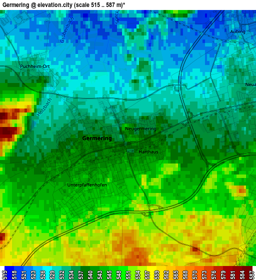
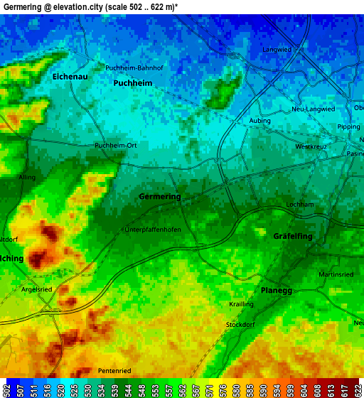
Below is the Elevation map of Germering, which displays elevation range with different colors. Scale of the first map is from 515 to 587 m (1690 to 1926 ft) with average elevation of 540 meters (=1772 ft) [note 1]
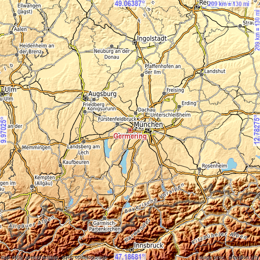
These maps also provides idea of topography and contour of this city, they are displayed at different zoom levels. More info about maps, scale and edge coordinates you can find below images.
| \ | Map #1 | Map #2 | Topo.Map |
| Scale [m] | 515..587 m | 502..622 m | × |
| Scale [ft] | 1690..1926 ft | 1647..2041 ft | × |
| Average | 540 m = 1772 ft | 544.7 m = 1787 ft | × |
| Width | 6.52 km = 4.1 mi | 13.04 km = 8.1 mi | 208.7 km = 129.7 mi |
| Height | 6.52 km = 4.1 mi | 13.04 km = 8.1 mi | 208.7 km = 129.7 mi |
| ↑Max Latitude | 48.16324° | 48.192544° | 49.06387° |
| Latitude at center | 48.13392° | 48.13392° | 48.13392° |
| ↓Min Latitude | 48.104583° | 48.075229° | 47.18681° |
| ← Min Longitude | 11.332555° | 11.288609° | 9.97025° |
| Longitude center | 11.3765° | 11.3765° | 11.3765° |
| →Max Longitude | 11.420445° | 11.464391° | 12.78275° |
Nearby cities:
Cities around Germering sort by population:
• Pasing elevation 527 m
6 km,  81°
81°
• Olching 509 m
8 km,  336°
336°
• Puchheim 527 m
2.7 km,  312°
312°
• Gauting 583 m
7.2 km,  179°
179°
• Gröbenzell 507 m
7.4 km,  354°
354°
• Gilching 562 m
6.8 km,  244°
244°
• Gräfelfing 543 m
4.3 km,  113°
113°
• Eichenau 527 m
5.7 km, 309°
• Planegg 547 m
4.7 km,  130°
130°
• Krailling 562 m
4.2 km,  155°
155°
• Neuried 558 m
8 km,  124°
124°
• Alling 541 m
5.6 km,  277°
277°
Multilingual:
 En español:
Germering elevación 544 m.
 En France:
Germering élévation 544 m.
 Auf Deutsch:
Germering höhe über dem Meeresspiegel ist 544 m.

Sources and notes:
- [note 1] Map square and city borders are not equal. Map elevation data is calculated only from area inside that square.
- [src 1] Elevation data from geonames database provided with same terms of usage.
- [src 2] The elevation map of Germering is generated using elevation data from NASA's 3 arcsec (90m) resolution SRTM data.
- [src 3] Base (background) map © OpenStreetMap contributors tiles are generated by Geofabrik and OpenTopoMap.
Copyright & License:
This Germering Elevation Map is licensed under CC BY-SA. You may reuse any part from this page, if you give a proper credit by linking to this URL:
 More info on terms of use page.