Gerolstein elevation
Gerolstein (Rheinland-Pfalz), Germany elevation is 363 meters and Gerolstein elevation in feet is 1191 ft above sea level [src 1]. Gerolstein is a populated place (feature code) with elevation that is 105 meters (344 ft) bigger than average city elevation in Germany.
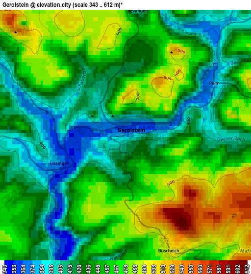
Below is the Elevation map of Gerolstein, which displays elevation range with different colors. Scale of the first map is from 343 to 612 m (1125 to 2008 ft) with average elevation of 448.6 meters (=1472 ft) [note 1]
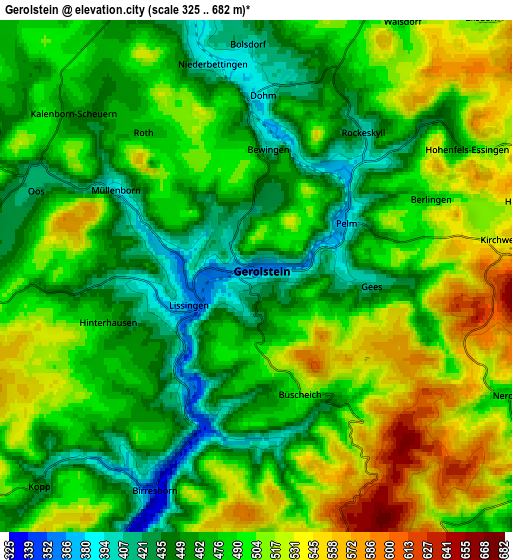
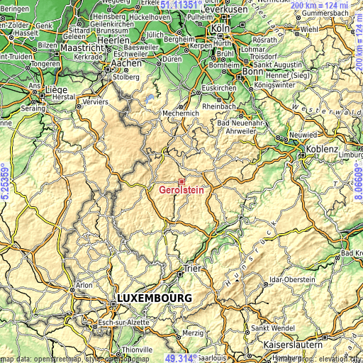
These maps also provides idea of topography and contour of this city, they are displayed at different zoom levels. More info about maps, scale and edge coordinates you can find below images.
| \ | Map #1 | Map #2 | Topo.Map |
| Scale [m] | 343..612 m | 325..682 m | × |
| Scale [ft] | 1125..2008 ft | 1066..2238 ft | × |
| Average | 448.6 m = 1472 ft | 484.7 m = 1590 ft | × |
| Width | 6.25 km = 3.9 mi | 12.51 km = 7.8 mi | 200.1 km = 124.3 mi |
| Height | 6.25 km = 3.9 mi | 12.51 km = 7.8 mi | 200.1 km = 124.3 mi |
| ↑Max Latitude | 50.250348° | 50.27844° | 51.11351° |
| Latitude at center | 50.22224° | 50.22224° | 50.22224° |
| ↓Min Latitude | 50.194115° | 50.165973° | 49.314° |
| ← Min Longitude | 6.615895° | 6.571949° | 5.25359° |
| Longitude center | 6.65984° | 6.65984° | 6.65984° |
| →Max Longitude | 6.703785° | 6.747731° | 8.06609° |
Nearby cities:
Cities around Gerolstein sort by population:
• Daun elevation 432 m
12.4 km,  103°
103°
• Hillesheim 444 m
7.8 km,  5°
5°
• Jünkerath 430 m
14.7 km,  337°
337°
• Schönecken 457 m
15.3 km,  242°
242°
• Stadtkyll 459 m
16.8 km,  327°
327°
• Üxheim 443 m
15.6 km,  24°
24°
• Mehren 498 m
16.5 km,  105°
105°
• Birresborn 341 m
4.7 km,  203°
203°
• Üdersdorf 440 m
12.8 km,  128°
128°
• Lissendorf 472 m
11.3 km, 337°
• Pelm 385 m
2.4 km,  64°
64°
• Weinsheim 600 m
13.8 km,  275°
275°
Multilingual:
 En español:
Gerolstein elevación 363 m.
 En France:
Gerolstein élévation 363 m.
 Auf Deutsch:
Gerolstein höhe über dem Meeresspiegel ist 363 m.

Sources and notes:
- [note 1] Map square and city borders are not equal. Map elevation data is calculated only from area inside that square.
- [src 1] Elevation data from geonames database provided with same terms of usage.
- [src 2] The elevation map of Gerolstein is generated using elevation data from NASA's 3 arcsec (90m) resolution SRTM data.
- [src 3] Base (background) map © OpenStreetMap contributors tiles are generated by Geofabrik and OpenTopoMap.
Copyright & License:
This Gerolstein Elevation Map is licensed under CC BY-SA. You may reuse any part from this page, if you give a proper credit by linking to this URL:
 More info on terms of use page.