Üxheim elevation
Üxheim (Rheinland-Pfalz), Germany elevation is 443 meters and Üxheim elevation in feet is 1453 ft above sea level [src 1]. Üxheim is a seat of a fourth-order administrative division (feature code) with elevation that is 185 meters (607 ft) bigger than average city elevation in Germany.
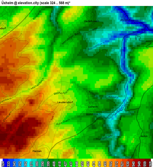
Below is the Elevation map of Üxheim, which displays elevation range with different colors. Scale of the first map is from 324 to 568 m (1063 to 1864 ft) with average elevation of 442.4 meters (=1451 ft) [note 1]
These maps also provides idea of topography and contour of this city, they are displayed at different zoom levels. More info about maps, scale and edge coordinates you can find below images.
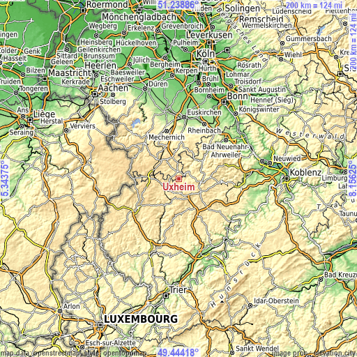
| \ | Map #1 | Topo.Map |
| Scale [m] | 324..568 m | × |
| Scale [ft] | 1063..1864 ft | × |
| Average | 442.4 m = 1451 ft | × |
| Width | 6.24 km = 3.9 mi | 199.5 km = 124 mi |
| Height | 6.24 km = 3.9 mi | 199.5 km = 124 mi |
| ↑Max Latitude | 50.378033° | 51.23886° |
| Latitude at center | 50.35° | 50.35° |
| ↓Min Latitude | 50.32195° | 49.44418° |
| ← Min Longitude | 6.706055° | 5.34375° |
| Longitude center | 6.75° | 6.75° |
| →Max Longitude | 6.793945° | 8.15625° |
Nearby cities:
Cities around Üxheim sort by population:
• Blankenheim elevation 518 m
11.7 km,  322°
322°
• Daun 432 m
17.9 km,  161°
161°
• Nettersheim 452 m
18.1 km,  331°
331°
• Gerolstein 363 m
15.6 km,  204°
204°
• Dahlem 493 m
14.9 km,  285°
285°
• Hillesheim 444 m
8.6 km,  221°
221°
• Adenau 309 m
13.5 km,  74°
74°
• Kelberg 481 m
13.7 km,  118°
118°
• Jünkerath 430 m
12 km,  266°
266°
• Stadtkyll 459 m
15.4 km, 270°
• Lissendorf 472 m
11.3 km,  250°
250°
• Pelm 385 m
13.8 km, 197°
Multilingual:
 En español:
Üxheim elevación 443 m.
 En France:
Üxheim élévation 443 m.


Sources and notes:
- [note 1] Map square and city borders are not equal. Map elevation data is calculated only from area inside that square.
- [src 1] Elevation data from geonames database provided with same terms of usage.
- [src 2] The elevation map of Üxheim is generated using elevation data from NASA's 3 arcsec (90m) resolution SRTM data.
- [src 3] Base (background) map © OpenStreetMap contributors tiles are generated by Geofabrik and OpenTopoMap.
Copyright & License:
This Üxheim Elevation Map is licensed under CC BY-SA. You may reuse any part from this page, if you give a proper credit by linking to this URL:
 More info on terms of use page.