Goldbach elevation
Goldbach (Thuringia), Germany elevation is 249 meters and Goldbach elevation in feet is 817 ft above sea level [src 1]. Goldbach is a populated place (feature code) with elevation that is 9 meters (30 ft) smaller than average city elevation in Germany.
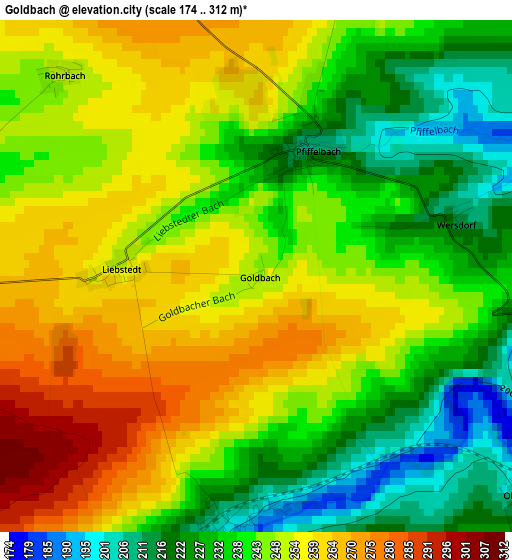
Below is the Elevation map of Goldbach, which displays elevation range with different colors. Scale of the first map is from 174 to 312 m (571 to 1024 ft) with average elevation of 244.5 meters (=802 ft) [note 1]
These maps also provides idea of topography and contour of this city, they are displayed at different zoom levels. More info about maps, scale and edge coordinates you can find below images.
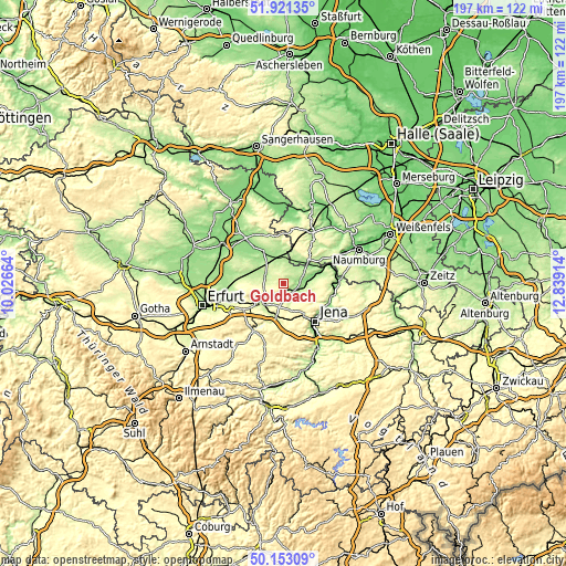
| \ | Map #1 | Topo.Map |
| Scale [m] | 174..312 m | × |
| Scale [ft] | 571..1024 ft | × |
| Average | 244.5 m = 802 ft | × |
| Width | 6.14 km = 3.8 mi | 196.6 km = 122.2 mi |
| Height | 6.14 km = 3.8 mi | 196.6 km = 122.2 mi |
| ↑Max Latitude | 51.07328° | 51.92135° |
| Latitude at center | 51.04566° | 51.04566° |
| ↓Min Latitude | 51.018023° | 50.15309° |
| ← Min Longitude | 11.388945° | 10.02664° |
| Longitude center | 11.43289° | 11.43289° |
| →Max Longitude | 11.476835° | 12.83914° |
Nearby cities:
Cities around Goldbach sort by population:
• Weimar elevation 220 m
10.3 km,  224°
224°
• Apolda 171 m
6.2 km,  110°
110°
• Bad Sulza 134 m
14.3 km,  70°
70°
• Buttstädt 192 m
8.6 km,  352°
352°
• Lehesten 258 m
12.6 km,  123°
123°
• Eckartsberga 243 m
12.4 km,  45°
45°
• Berlstedt 226 m
13.4 km,  277°
277°
• Kromsdorf 207 m
6.9 km, 222°
• Buttelstedt 190 m
7.1 km,  298°
298°
• Oßmanstedt 199 m
3.1 km,  187°
187°
• Niederroßla 181 m
3.8 km, 111°
• Mellingen 228 m
11.9 km, 192°
Multilingual:
 En español:
Goldbach elevación 249 m.
 En France:
Goldbach élévation 249 m.
 Auf Deutsch:
Goldbach höhe über dem Meeresspiegel ist 249 m.

Sources and notes:
- [note 1] Map square and city borders are not equal. Map elevation data is calculated only from area inside that square.
- [src 1] Elevation data from geonames database provided with same terms of usage.
- [src 2] The elevation map of Goldbach is generated using elevation data from NASA's 3 arcsec (90m) resolution SRTM data.
- [src 3] Base (background) map © OpenStreetMap contributors tiles are generated by Geofabrik and OpenTopoMap.
Copyright & License:
This Goldbach Elevation Map is licensed under CC BY-SA. You may reuse any part from this page, if you give a proper credit by linking to this URL:
 More info on terms of use page.