Weimar elevation
Weimar (Thuringia), Germany elevation is 220 meters and Weimar elevation in feet is 722 ft above sea level [src 1]. Weimar is a seat of a third-order administrative division (feature code) with elevation that is 38 meters (125 ft) smaller than average city elevation in Germany.
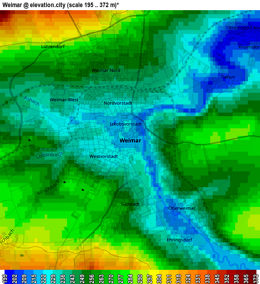
Below is the Elevation map of Weimar, which displays elevation range with different colors. Scale of the first map is from 195 to 372 m (640 to 1220 ft) with average elevation of 254.7 meters (=836 ft) [note 1]
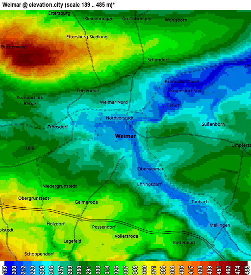
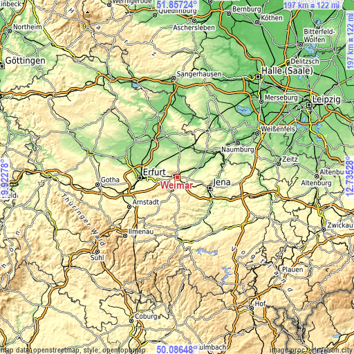
These maps also provides idea of topography and contour of this city, they are displayed at different zoom levels. More info about maps, scale and edge coordinates you can find below images.
| \ | Map #1 | Map #2 | Topo.Map |
| Scale [m] | 195..372 m | 189..485 m | × |
| Scale [ft] | 640..1220 ft | 620..1591 ft | × |
| Average | 254.7 m = 836 ft | 295.8 m = 970 ft | × |
| Width | 6.15 km = 3.8 mi | 12.31 km = 7.6 mi | 196.9 km = 122.3 mi |
| Height | 6.15 km = 3.8 mi | 12.31 km = 7.6 mi | 196.9 km = 122.3 mi |
| ↑Max Latitude | 51.007959° | 51.035602° | 51.85724° |
| Latitude at center | 50.9803° | 50.9803° | 50.9803° |
| ↓Min Latitude | 50.952624° | 50.924932° | 50.08648° |
| ← Min Longitude | 11.285085° | 11.241139° | 9.92278° |
| Longitude center | 11.32903° | 11.32903° | 11.32903° |
| →Max Longitude | 11.372975° | 11.416921° | 12.73528° |
Nearby cities:
Cities around Weimar sort by population:
• Bad Berka elevation 273 m
9.5 km,  200°
200°
• Magdala 275 m
11.7 km,  134°
134°
• Goldbach 249 m
10.3 km,  44°
44°
• Berlstedt 226 m
10.8 km,  326°
326°
• Mönchenholzhausen 270 m
12.6 km,  263°
263°
• Kromsdorf 207 m
3.4 km,  50°
50°
• Nohra 318 m
5.3 km,  246°
246°
• Buttelstedt 190 m
10.7 km,  5°
5°
• Oßmanstedt 199 m
8.1 km,  58°
58°
• Niederroßla 181 m
12.3 km, 61°
• Mellingen 228 m
6.4 km, 132°
• Niederzimmern 201 m
10.1 km,  285°
285°
Multilingual:
 En español:
Weimar elevación 220 m.
 En France:
Weimar élévation 220 m.


Sources and notes:
- [note 1] Map square and city borders are not equal. Map elevation data is calculated only from area inside that square.
- [src 1] Elevation data from geonames database provided with same terms of usage.
- [src 2] The elevation map of Weimar is generated using elevation data from NASA's 3 arcsec (90m) resolution SRTM data.
- [src 3] Base (background) map © OpenStreetMap contributors tiles are generated by Geofabrik and OpenTopoMap.
Copyright & License:
This Weimar Elevation Map is licensed under CC BY-SA. You may reuse any part from this page, if you give a proper credit by linking to this URL:
 More info on terms of use page.