Grefrath elevation
Grefrath (North Rhine-Westphalia, Düsseldorf District), Germany elevation is 38 meters and Grefrath elevation in feet is 125 ft above sea level [src 1]. Grefrath is a seat of a fourth-order administrative division (feature code) with elevation that is 220 meters (722 ft) smaller than average city elevation in Germany.
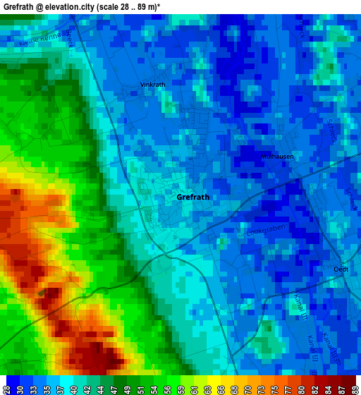
Below is the Elevation map of Grefrath, which displays elevation range with different colors. Scale of the first map is from 28 to 89 m (92 to 292 ft) with average elevation of 42.8 meters (=140 ft) [note 1]
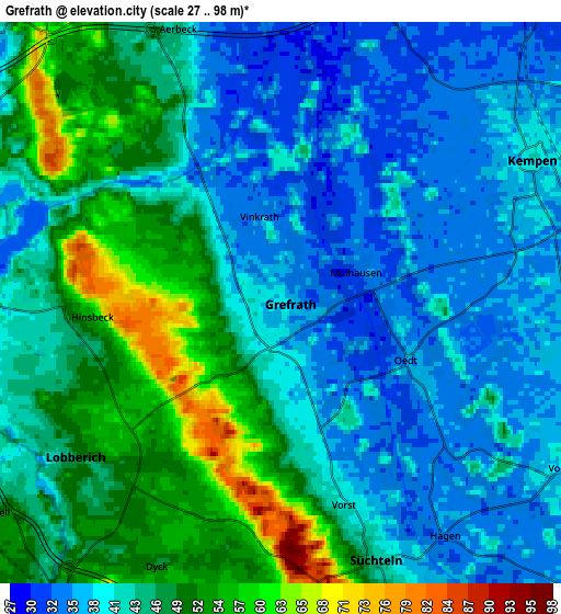
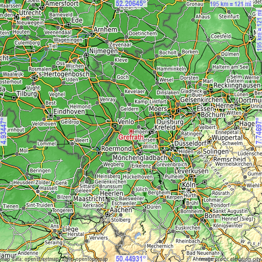
These maps also provides idea of topography and contour of this city, they are displayed at different zoom levels. More info about maps, scale and edge coordinates you can find below images.
| \ | Map #1 | Map #2 | Topo.Map |
| Scale [m] | 28..89 m | 27..98 m | × |
| Scale [ft] | 92..292 ft | 89..322 ft | × |
| Average | 42.8 m = 140 ft | 43.6 m = 143 ft | × |
| Width | 6.11 km = 3.8 mi | 12.21 km = 7.6 mi | 195.4 km = 121.4 mi |
| Height | 6.11 km = 3.8 mi | 12.21 km = 7.6 mi | 195.4 km = 121.4 mi |
| ↑Max Latitude | 51.363747° | 51.391177° | 52.20645° |
| Latitude at center | 51.3363° | 51.3363° | 51.3363° |
| ↓Min Latitude | 51.308837° | 51.281358° | 50.44931° |
| ← Min Longitude | 6.296775° | 6.252829° | 4.93447° |
| Longitude center | 6.34072° | 6.34072° | 6.34072° |
| →Max Longitude | 6.384665° | 6.428611° | 7.74697° |
Nearby cities:
Cities around Grefrath sort by population:
• Krefeld elevation 43 m
14.8 km,  89°
89°
• Viersen 44 m
9.8 km,  157°
157°
• Willich 43 m
16.5 km,  119°
119°
• Nettetal 52 m
4.5 km,  241°
241°
• Kempen 41 m
6.2 km,  60°
60°
• Tönisvorst 42 m
10.8 km,  99°
99°
• Schwalmtal 62 m
14.3 km,  201°
201°
• Brüggen 44 m
15.2 km,  225°
225°
• Niederkrüchten 54 m
17.4 km,  209°
209°
• Straelen 46 m
12.8 km,  336°
336°
• Wachtendonk 31 m
8.1 km,  359°
359°
• Rheurdt 42 m
16.9 km,  31°
31°
Multilingual:
 En español:
Grefrath elevación 38 m.
 En France:
Grefrath élévation 38 m.


Sources and notes:
- [note 1] Map square and city borders are not equal. Map elevation data is calculated only from area inside that square.
- [src 1] Elevation data from geonames database provided with same terms of usage.
- [src 2] The elevation map of Grefrath is generated using elevation data from NASA's 3 arcsec (90m) resolution SRTM data.
- [src 3] Base (background) map © OpenStreetMap contributors tiles are generated by Geofabrik and OpenTopoMap.
Copyright & License:
This Grefrath Elevation Map is licensed under CC BY-SA. You may reuse any part from this page, if you give a proper credit by linking to this URL:
 More info on terms of use page.