Straelen elevation
Straelen (North Rhine-Westphalia, Düsseldorf District), Germany elevation is 46 meters and Straelen elevation in feet is 151 ft above sea level [src 1]. Straelen is a populated place (feature code) with elevation that is 212 meters (696 ft) smaller than average city elevation in Germany.
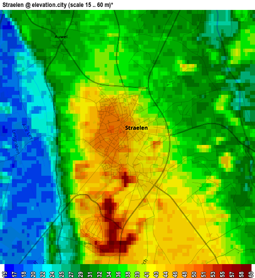
Below is the Elevation map of Straelen, which displays elevation range with different colors. Scale of the first map is from 15 to 60 m (49 to 197 ft) with average elevation of 34.2 meters (=112 ft) [note 1]
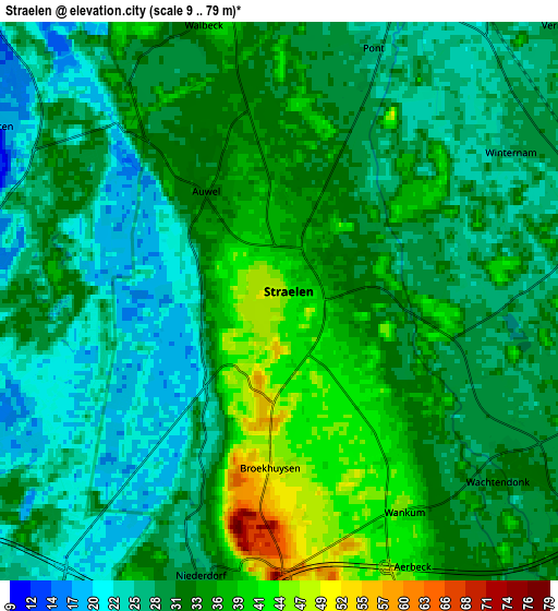
These maps also provides idea of topography and contour of this city, they are displayed at different zoom levels. More info about maps, scale and edge coordinates you can find below images.
| \ | Map #1 | Map #2 | Topo.Map |
| Scale [m] | 15..60 m | 9..79 m | × |
| Scale [ft] | 49..197 ft | 30..259 ft | × |
| Average | 34.2 m = 112 ft | 30.9 m = 101 ft | × |
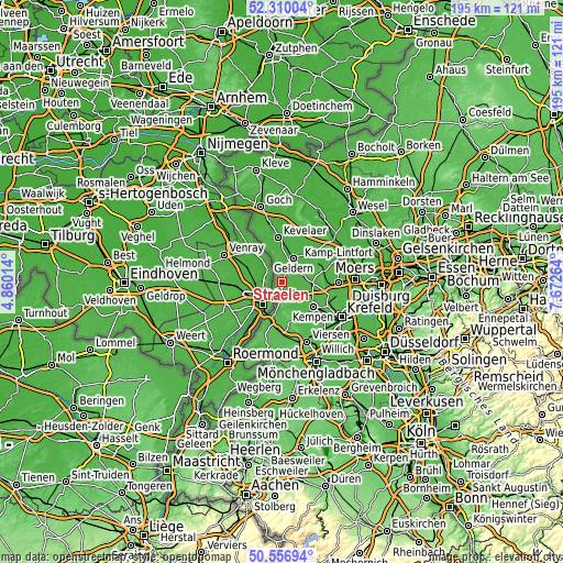
| Width | 6.09 km = 3.8 mi | 12.18 km = 7.6 mi | 194.9 km = 121.1 mi |
| Height | 6.09 km = 3.8 mi | 12.18 km = 7.6 mi | 194.9 km = 121.1 mi |
| ↑Max Latitude | 51.469283° | 51.49665° | 52.31004° |
| Latitude at center | 51.4419° | 51.4419° | 51.4419° |
| ↓Min Latitude | 51.4145° | 51.387084° | 50.55694° |
| ← Min Longitude | 6.222445° | 6.178499° | 4.86014° |
| Longitude center | 6.26639° | 6.26639° | 6.26639° |
| →Max Longitude | 6.310335° | 6.354281° | 7.67264° |
Nearby cities:
Cities around Straelen sort by population:
• Nettetal elevation 52 m
14 km,  175°
175°
• Kamp-Lintfort 30 m
20.6 km,  70°
70°
• Kempen 41 m
13.6 km,  129°
129°
• Geldern 28 m
9.5 km,  24°
24°
• Tönisvorst 42 m
20.8 km, 130°
• Kevelaer 25 m
15.7 km,  354°
354°
• Grefrath 38 m
12.8 km,  156°
156°
• Issum 25 m
15.4 km,  48°
48°
• Weeze 21 m
21.1 km, 347°
• Sonsbeck 25 m
20 km, 22°
• Wachtendonk 31 m
6.2 km, 125°
• Rheurdt 42 m
14.1 km,  78°
78°
Multilingual:
 En español:
Straelen elevación 46 m.
 En France:
Straelen élévation 46 m.


Sources and notes:
- [note 1] Map square and city borders are not equal. Map elevation data is calculated only from area inside that square.
- [src 1] Elevation data from geonames database provided with same terms of usage.
- [src 2] The elevation map of Straelen is generated using elevation data from NASA's 3 arcsec (90m) resolution SRTM data.
- [src 3] Base (background) map © OpenStreetMap contributors tiles are generated by Geofabrik and OpenTopoMap.
Copyright & License:
This Straelen Elevation Map is licensed under CC BY-SA. You may reuse any part from this page, if you give a proper credit by linking to this URL:
 More info on terms of use page.