Bad Griesbach elevation
Bad Griesbach (Bavaria, Lower Bavaria), Germany elevation is 454 meters and Bad Griesbach elevation in feet is 1490 ft above sea level [src 1]. Bad Griesbach is a populated place (feature code) with elevation that is 196 meters (643 ft) bigger than average city elevation in Germany.
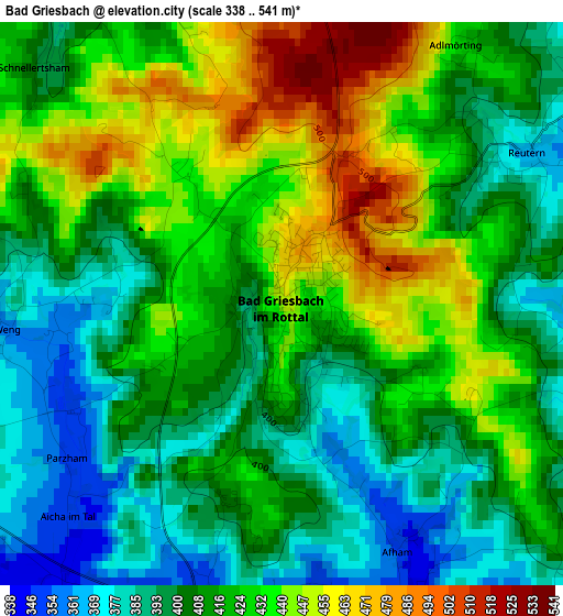
Below is the Elevation map of Bad Griesbach, which displays elevation range with different colors. Scale of the first map is from 338 to 541 m (1109 to 1775 ft) with average elevation of 416.6 meters (=1367 ft) [note 1]
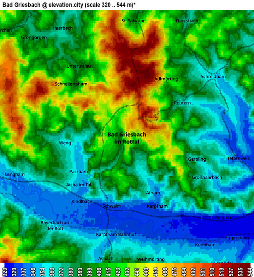
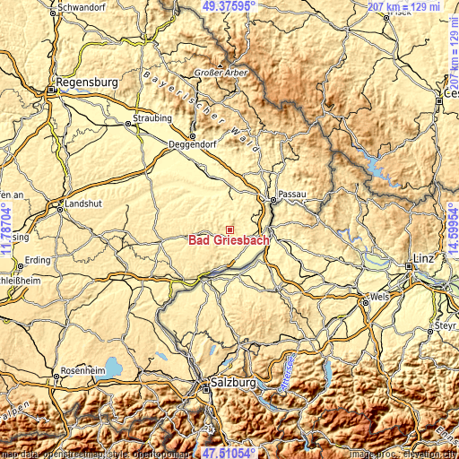
These maps also provides idea of topography and contour of this city, they are displayed at different zoom levels. More info about maps, scale and edge coordinates you can find below images.
| \ | Map #1 | Map #2 | Topo.Map |
| Scale [m] | 338..541 m | 320..544 m | × |
| Scale [ft] | 1109..1775 ft | 1050..1785 ft | × |
| Average | 416.6 m = 1367 ft | 397.4 m = 1304 ft | × |
| Width | 6.48 km = 4 mi | 12.96 km = 8.1 mi | 207.4 km = 128.9 mi |
| Height | 6.48 km = 4 mi | 12.96 km = 8.1 mi | 207.4 km = 128.9 mi |
| ↑Max Latitude | 48.480948° | 48.51007° | 49.37595° |
| Latitude at center | 48.45181° | 48.45181° | 48.45181° |
| ↓Min Latitude | 48.422655° | 48.393483° | 47.51054° |
| ← Min Longitude | 13.149345° | 13.105399° | 11.78704° |
| Longitude center | 13.19329° | 13.19329° | 13.19329° |
| →Max Longitude | 13.237235° | 13.281181° | 14.59954° |
Nearby cities:
Cities around Bad Griesbach sort by population:
• Pocking elevation 321 m
10.5 km,  122°
122°
• Fürstenzell 363 m
12 km,  49°
49°
• Ortenburg 347 m
10.7 km,  11°
11°
• Bad Birnbach 360 m
7.6 km,  264°
264°
• Rotthalmünster 370 m
10.4 km,  176°
176°
• Haarbach 374 m
6.2 km,  329°
329°
• Egglham 351 m
13.4 km,  309°
309°
• Kirchham 333 m
12.9 km,  155°
155°
• Chostlarn 431 m
10.4 km,  210°
210°
• Tettenweis 334 m
5.7 km,  100°
100°
• Bayerbach 357 m
5.9 km,  218°
218°
• Beutelsbach 357 m
12.3 km, 332°
Multilingual:
 En español:
Bad Griesbach elevación 454 m.
 En France:
Bad Griesbach élévation 454 m.
 Auf Deutsch:
Bad Griesbach im Rottal höhe über dem Meeresspiegel ist 454 m.

Sources and notes:
- [note 1] Map square and city borders are not equal. Map elevation data is calculated only from area inside that square.
- [src 1] Elevation data from geonames database provided with same terms of usage.
- [src 2] The elevation map of Bad Griesbach is generated using elevation data from NASA's 3 arcsec (90m) resolution SRTM data.
- [src 3] Base (background) map © OpenStreetMap contributors tiles are generated by Geofabrik and OpenTopoMap.
Copyright & License:
This Bad Griesbach Elevation Map is licensed under CC BY-SA. You may reuse any part from this page, if you give a proper credit by linking to this URL:
 More info on terms of use page.