Großenehrich elevation
Großenehrich (Thuringia), Germany elevation is 248 meters and Großenehrich elevation in feet is 814 ft above sea level [src 1]. Großenehrich is a seat of a fourth-order administrative division (feature code) with elevation that is 10 meters (33 ft) smaller than average city elevation in Germany.
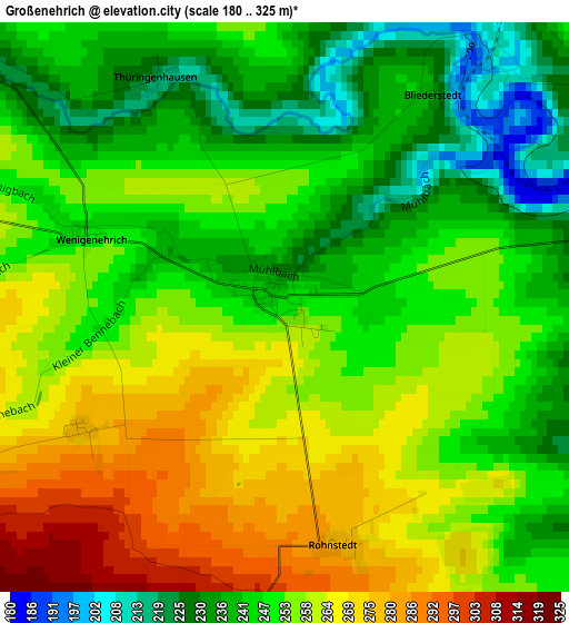
Below is the Elevation map of Großenehrich, which displays elevation range with different colors. Scale of the first map is from 180 to 325 m (591 to 1066 ft) with average elevation of 252.4 meters (=828 ft) [note 1]
These maps also provides idea of topography and contour of this city, they are displayed at different zoom levels. More info about maps, scale and edge coordinates you can find below images.
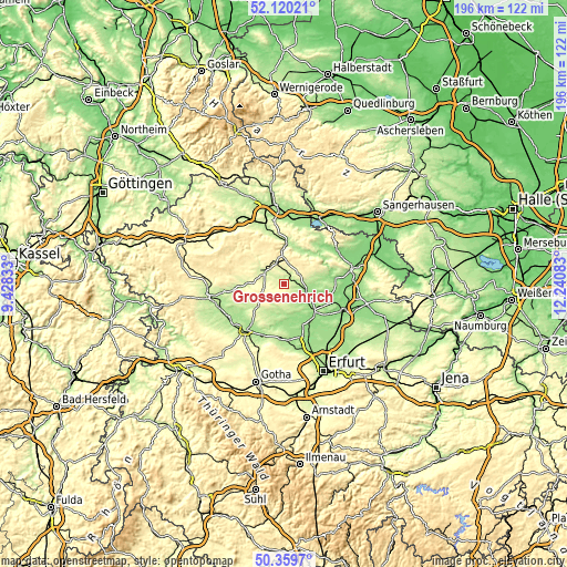
| \ | Map #1 | Topo.Map |
| Scale [m] | 180..325 m | × |
| Scale [ft] | 591..1066 ft | × |
| Average | 252.4 m = 828 ft | × |
| Width | 6.12 km = 3.8 mi | 195.8 km = 121.7 mi |
| Height | 6.12 km = 3.8 mi | 195.7 km = 121.6 mi |
| ↑Max Latitude | 51.275879° | 52.12021° |
| Latitude at center | 51.24838° | 51.24838° |
| ↓Min Latitude | 51.220864° | 50.3597° |
| ← Min Longitude | 10.790635° | 9.42833° |
| Longitude center | 10.83458° | 10.83458° |
| →Max Longitude | 10.878525° | 12.24083° |
Nearby cities:
Cities around Großenehrich sort by population:
• Sondershausen elevation 192 m
13.7 km,  10°
10°
• Schlotheim 242 m
12.3 km,  268°
268°
• Greußen 162 m
7.9 km,  105°
105°
• Schernberg 334 m
9.9 km,  332°
332°
• Ebeleben 249 m
8.2 km,  297°
297°
• Herbsleben 175 m
14.6 km,  180°
180°
• Bad Tennstedt 174 m
10.4 km, 178°
• Gebesee 153 m
16.4 km,  154°
154°
• Straußfurt 160 m
13.8 km,  131°
131°
• Gangloffsömmern 169 m
10 km, 130°
• Clingen 166 m
7.1 km,  104°
104°
• Freienbessingen 295 m
5 km,  250°
250°
Multilingual:
 En español:
Großenehrich elevación 248 m.
 En France:
Großenehrich élévation 248 m.
 Auf Deutsch:
Großenehrich höhe über dem Meeresspiegel ist 248 m.

Sources and notes:
- [note 1] Map square and city borders are not equal. Map elevation data is calculated only from area inside that square.
- [src 1] Elevation data from geonames database provided with same terms of usage.
- [src 2] The elevation map of Großenehrich is generated using elevation data from NASA's 3 arcsec (90m) resolution SRTM data.
- [src 3] Base (background) map © OpenStreetMap contributors tiles are generated by Geofabrik and OpenTopoMap.
Copyright & License:
This Großenehrich Elevation Map is licensed under CC BY-SA. You may reuse any part from this page, if you give a proper credit by linking to this URL:
 More info on terms of use page.