Haina elevation
Haina (Hesse, Regierungsbezirk Kassel), Germany elevation is 325 meters and Haina elevation in feet is 1066 ft above sea level [src 1]. Haina is a populated place (feature code) with elevation that is 67 meters (220 ft) bigger than average city elevation in Germany.
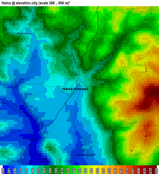
Below is the Elevation map of Haina, which displays elevation range with different colors. Scale of the first map is from 266 to 650 m (873 to 2133 ft) with average elevation of 390.6 meters (=1281 ft) [note 1]
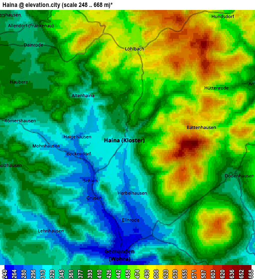
These maps also provides idea of topography and contour of this city, they are displayed at different zoom levels. More info about maps, scale and edge coordinates you can find below images.
| \ | Map #1 | Map #2 | Topo.Map |
| Scale [m] | 266..650 m | 248..668 m | × |
| Scale [ft] | 873..2133 ft | 814..2192 ft | × |
| Average | 390.6 m = 1281 ft | 406.7 m = 1334 ft | × |
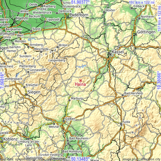
| Width | 6.15 km = 3.8 mi | 12.29 km = 7.6 mi | 196.7 km = 122.2 mi |
| Height | 6.15 km = 3.8 mi | 12.29 km = 7.6 mi | 196.7 km = 122.2 mi |
| ↑Max Latitude | 51.055371° | 51.082985° | 51.90377° |
| Latitude at center | 51.02774° | 51.02774° | 51.02774° |
| ↓Min Latitude | 51.000093° | 50.972429° | 50.13483° |
| ← Min Longitude | 8.930465° | 8.886519° | 7.56816° |
| Longitude center | 8.97441° | 8.97441° | 8.97441° |
| →Max Longitude | 9.018355° | 9.062301° | 10.38066° |
Nearby cities:
Cities around Haina sort by population:
• Schwalmstadt elevation 235 m
19.9 km,  121°
121°
• Frankenberg 314 m
12.6 km,  285°
285°
• Bad Wildungen 276 m
14.7 km,  45°
45°
• Rauschenberg 247 m
16.5 km,  193°
193°
• Gemünden an der Wohra 249 m
6 km,  183°
183°
• Münchhausen 243 m
19.4 km,  247°
247°
• Frankenau 434 m
7.7 km,  338°
338°
• Gilserberg 346 m
10.8 km,  143°
143°
• Neuental 231 m
17.2 km,  100°
100°
• Jesberg 234 m
12.7 km, 104°
• Rosenthal 276 m
9.6 km,  231°
231°
• Reinhardshausen 322 m
11.7 km,  37°
37°
Multilingual:
 En español:
Haina elevación 325 m.
 En France:
Haina élévation 325 m.


Sources and notes:
- [note 1] Map square and city borders are not equal. Map elevation data is calculated only from area inside that square.
- [src 1] Elevation data from geonames database provided with same terms of usage.
- [src 2] The elevation map of Haina is generated using elevation data from NASA's 3 arcsec (90m) resolution SRTM data.
- [src 3] Base (background) map © OpenStreetMap contributors tiles are generated by Geofabrik and OpenTopoMap.
Copyright & License:
This Haina Elevation Map is licensed under CC BY-SA. You may reuse any part from this page, if you give a proper credit by linking to this URL:
 More info on terms of use page.