Hallerndorf elevation
Hallerndorf (Bavaria, Upper Franconia), Germany elevation is 269 meters and Hallerndorf elevation in feet is 883 ft above sea level [src 1]. Hallerndorf is a seat of a fourth-order administrative division (feature code) with elevation that is 11 meters (36 ft) bigger than average city elevation in Germany.
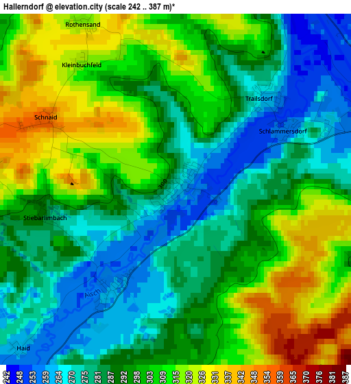
Below is the Elevation map of Hallerndorf, which displays elevation range with different colors. Scale of the first map is from 242 to 387 m (794 to 1270 ft) with average elevation of 295.7 meters (=970 ft) [note 1]
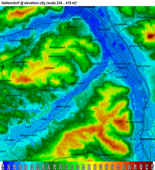
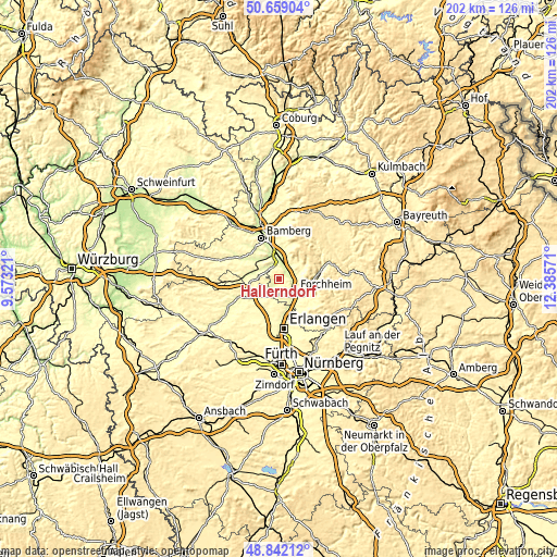
These maps also provides idea of topography and contour of this city, they are displayed at different zoom levels. More info about maps, scale and edge coordinates you can find below images.
| \ | Map #1 | Map #2 | Topo.Map |
| Scale [m] | 242..387 m | 234..419 m | × |
| Scale [ft] | 794..1270 ft | 768..1375 ft | × |
| Average | 295.7 m = 970 ft | 292.2 m = 959 ft | × |
| Width | 6.31 km = 3.9 mi | 12.63 km = 7.8 mi | 202 km = 125.5 mi |
| Height | 6.31 km = 3.9 mi | 12.63 km = 7.8 mi | 202 km = 125.5 mi |
| ↑Max Latitude | 49.78747° | 49.815834° | 50.65904° |
| Latitude at center | 49.75909° | 49.75909° | 49.75909° |
| ↓Min Latitude | 49.730693° | 49.702279° | 48.84212° |
| ← Min Longitude | 10.935515° | 10.891569° | 9.57321° |
| Longitude center | 10.97946° | 10.97946° | 10.97946° |
| →Max Longitude | 11.023405° | 11.067351° | 12.38571° |
Nearby cities:
Cities around Hallerndorf sort by population:
• Forchheim elevation 261 m
7.3 km,  129°
129°
• Hirschaid 252 m
6.6 km,  6°
6°
• Strullendorf 254 m
9.5 km,  356°
356°
• Eggolsheim 263 m
5.7 km,  78°
78°
• Hemhofen 317 m
9.1 km,  201°
201°
• Heroldsbach 283 m
7.4 km,  169°
169°
• Frensdorf 257 m
10.3 km,  308°
308°
• Röttenbach 311 m
11.2 km, 200°
• Hausen 273 m
8.6 km,  153°
153°
• Buttenheim 270 m
6.1 km,  36°
36°
• Weilersbach 369 m
9.9 km,  95°
95°
• Pettstadt 248 m
8.7 km,  335°
335°
Multilingual:
 En español:
Hallerndorf elevación 269 m.
 En France:
Hallerndorf élévation 269 m.
 Auf Deutsch:
Hallerndorf höhe über dem Meeresspiegel ist 269 m.

Sources and notes:
- [note 1] Map square and city borders are not equal. Map elevation data is calculated only from area inside that square.
- [src 1] Elevation data from geonames database provided with same terms of usage.
- [src 2] The elevation map of Hallerndorf is generated using elevation data from NASA's 3 arcsec (90m) resolution SRTM data.
- [src 3] Base (background) map © OpenStreetMap contributors tiles are generated by Geofabrik and OpenTopoMap.
Copyright & License:
This Hallerndorf Elevation Map is licensed under CC BY-SA. You may reuse any part from this page, if you give a proper credit by linking to this URL:
 More info on terms of use page.