Hirschaid elevation
Hirschaid (Bavaria, Upper Franconia), Germany elevation is 252 meters and Hirschaid elevation in feet is 827 ft above sea level [src 1]. Hirschaid is a populated place (feature code) with elevation that is 6 meters (20 ft) smaller than average city elevation in Germany.
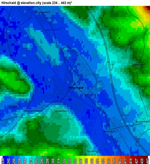
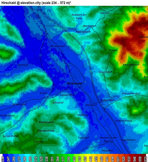
Below is the Elevation map of Hirschaid, which displays elevation range with different colors. Scale of the first map is from 234 to 443 m (768 to 1453 ft) with average elevation of 271.5 meters (=891 ft) [note 1]
These maps also provides idea of topography and contour of this city, they are displayed at different zoom levels. More info about maps, scale and edge coordinates you can find below images.
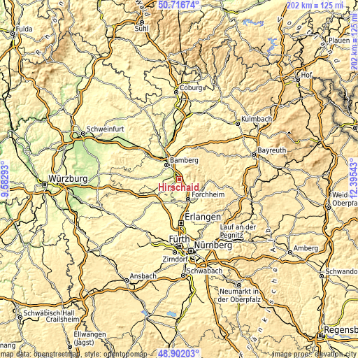
| \ | Map #1 | Map #2 | Topo.Map |
| Scale [m] | 234..443 m | 234..572 m | × |
| Scale [ft] | 768..1453 ft | 768..1877 ft | × |
| Average | 271.5 m = 891 ft | 303.7 m = 996 ft | × |
| Width | 6.31 km = 3.9 mi | 12.61 km = 7.8 mi | 201.8 km = 125.4 mi |
| Height | 6.31 km = 3.9 mi | 12.61 km = 7.8 mi | 201.8 km = 125.4 mi |
| ↑Max Latitude | 49.846236° | 49.874565° | 50.71674° |
| Latitude at center | 49.81789° | 49.81789° | 49.81789° |
| ↓Min Latitude | 49.789527° | 49.761148° | 48.90203° |
| ← Min Longitude | 10.945235° | 10.901289° | 9.58293° |
| Longitude center | 10.98918° | 10.98918° | 10.98918° |
| →Max Longitude | 11.033125° | 11.077071° | 12.39543° |
Nearby cities:
Cities around Hirschaid sort by population:
• Bamberg elevation 243 m
11 km,  324°
324°
• Forchheim 261 m
12.2 km,  155°
155°
• Memmelsdorf 285 m
12.7 km,  350°
350°
• Strullendorf 254 m
3.2 km,  337°
337°
• Stegaurach 287 m
11.7 km,  296°
296°
• Eggolsheim 263 m
7.2 km,  137°
137°
• Litzendorf 318 m
10.8 km,  8°
8°
• Frensdorf 257 m
8.8 km,  269°
269°
• Hallerndorf 269 m
6.6 km,  186°
186°
• Buttenheim 270 m
3.3 km,  118°
118°
• Weilersbach 369 m
11.9 km,  129°
129°
• Pettstadt 248 m
4.6 km,  287°
287°
Multilingual:
 En español:
Hirschaid elevación 252 m.
 En France:
Hirschaid élévation 252 m.
 Auf Deutsch:
Hirschaid höhe über dem Meeresspiegel ist 252 m.

Sources and notes:
- [note 1] Map square and city borders are not equal. Map elevation data is calculated only from area inside that square.
- [src 1] Elevation data from geonames database provided with same terms of usage.
- [src 2] The elevation map of Hirschaid is generated using elevation data from NASA's 3 arcsec (90m) resolution SRTM data.
- [src 3] Base (background) map © OpenStreetMap contributors tiles are generated by Geofabrik and OpenTopoMap.
Copyright & License:
This Hirschaid Elevation Map is licensed under CC BY-SA. You may reuse any part from this page, if you give a proper credit by linking to this URL:
 More info on terms of use page.