Hartha elevation
Hartha (Saxony), Germany elevation is 262 meters and Hartha elevation in feet is 860 ft above sea level [src 1]. Hartha is a populated place (feature code) with elevation that is 4 meters (13 ft) bigger than average city elevation in Germany.
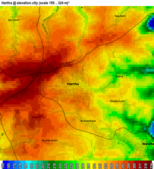
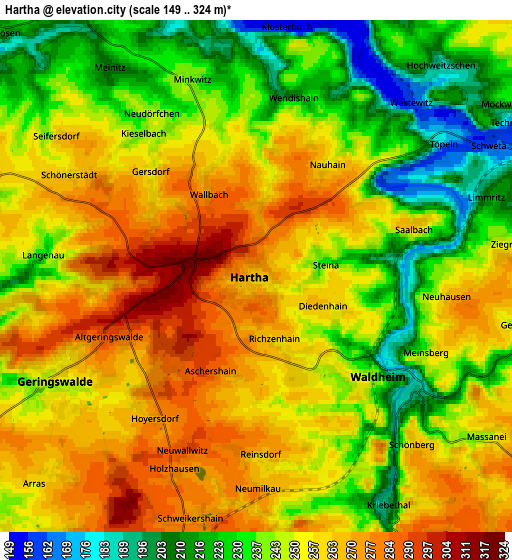
Below is the Elevation map of Hartha, which displays elevation range with different colors. Scale of the first map is from 159 to 324 m (522 to 1063 ft) with average elevation of 271.5 meters (=891 ft) [note 1]
These maps also provides idea of topography and contour of this city, they are displayed at different zoom levels. More info about maps, scale and edge coordinates you can find below images.
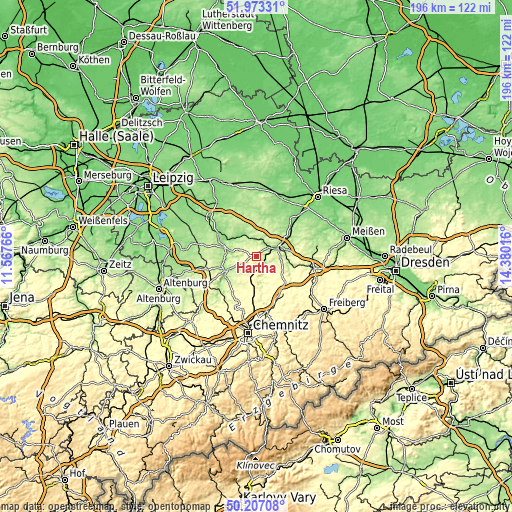
| \ | Map #1 | Map #2 | Topo.Map |
| Scale [m] | 159..324 m | 149..324 m | × |
| Scale [ft] | 522..1063 ft | 489..1063 ft | × |
| Average | 271.5 m = 891 ft | 249.6 m = 819 ft | × |
| Width | 6.14 km = 3.8 mi | 12.27 km = 7.6 mi | 196.4 km = 122 mi |
| Height | 6.14 km = 3.8 mi | 12.27 km = 7.6 mi | 196.4 km = 122 mi |
| ↑Max Latitude | 51.126219° | 51.153791° | 51.97331° |
| Latitude at center | 51.09863° | 51.09863° | 51.09863° |
| ↓Min Latitude | 51.071025° | 51.043403° | 50.20708° |
| ← Min Longitude | 12.929965° | 12.886019° | 11.56766° |
| Longitude center | 12.97391° | 12.97391° | 12.97391° |
| →Max Longitude | 13.017855° | 13.061801° | 14.38016° |
Nearby cities:
Cities around Hartha sort by population:
• Döbeln elevation 168 m
9.9 km,  74°
74°
• Waldheim 191 m
4.3 km,  131°
131°
• Leisnig 221 m
7.3 km,  333°
333°
• Geringswalde 252 m
5.3 km,  242°
242°
• Zschadrass 223 m
11.7 km,  292°
292°
• Erlau 315 m
10.1 km,  191°
191°
• Großweitzschen 256 m
8.3 km,  36°
36°
• Bockelwitz 215 m
11.3 km,  353°
353°
• Kriebstein 194 m
6.2 km,  151°
151°
• Niederstriegis 190 m
12.4 km,  98°
98°
• Gersdorf 269 m
2.9 km,  301°
301°
• Ebersbach 219 m
9.7 km,  89°
89°
Multilingual:
 En español:
Hartha elevación 262 m.
 En France:
Hartha élévation 262 m.


Sources and notes:
- [note 1] Map square and city borders are not equal. Map elevation data is calculated only from area inside that square.
- [src 1] Elevation data from geonames database provided with same terms of usage.
- [src 2] The elevation map of Hartha is generated using elevation data from NASA's 3 arcsec (90m) resolution SRTM data.
- [src 3] Base (background) map © OpenStreetMap contributors tiles are generated by Geofabrik and OpenTopoMap.
Copyright & License:
This Hartha Elevation Map is licensed under CC BY-SA. You may reuse any part from this page, if you give a proper credit by linking to this URL:
 More info on terms of use page.