Heustreu elevation
Heustreu (Bavaria, Regierungsbezirk Unterfranken), Germany elevation is 251 meters and Heustreu elevation in feet is 823 ft above sea level [src 1]. Heustreu is a seat of a fourth-order administrative division (feature code) with elevation that is 7 meters (23 ft) smaller than average city elevation in Germany.
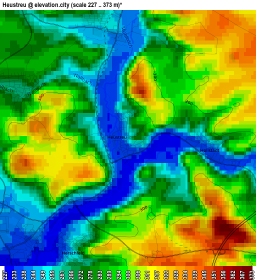
Below is the Elevation map of Heustreu, which displays elevation range with different colors. Scale of the first map is from 227 to 373 m (745 to 1224 ft) with average elevation of 284.5 meters (=933 ft) [note 1]
These maps also provides idea of topography and contour of this city, they are displayed at different zoom levels. More info about maps, scale and edge coordinates you can find below images.
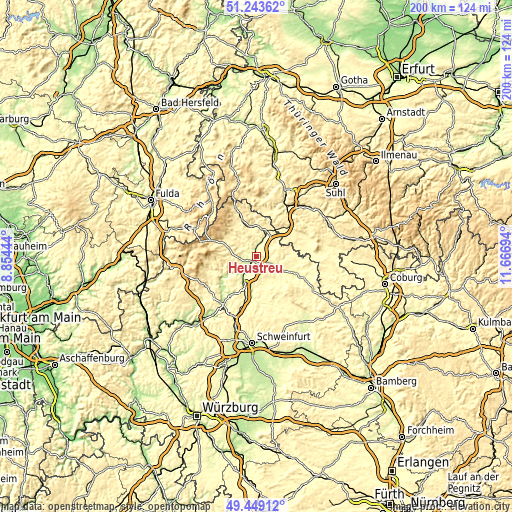
| \ | Map #1 | Topo.Map |
| Scale [m] | 227..373 m | × |
| Scale [ft] | 745..1224 ft | × |
| Average | 284.5 m = 933 ft | × |
| Width | 6.24 km = 3.9 mi | 199.5 km = 124 mi |
| Height | 6.24 km = 3.9 mi | 199.5 km = 124 mi |
| ↑Max Latitude | 50.38288° | 51.24362° |
| Latitude at center | 50.35485° | 50.35485° |
| ↓Min Latitude | 50.326803° | 49.44912° |
| ← Min Longitude | 10.216745° | 8.85444° |
| Longitude center | 10.26069° | 10.26069° |
| →Max Longitude | 10.304635° | 11.66694° |
Nearby cities:
Cities around Heustreu sort by population:
• Bad Neustadt an der Saale elevation 235 m
5.3 km,  226°
226°
• Mellrichstadt 280 m
8.7 km,  20°
20°
• Bastheim 291 m
6.5 km,  321°
321°
• Salz 241 m
6.2 km,  213°
213°
• Niederlauer 239 m
9 km,  221°
221°
• Oberstreu 258 m
5.7 km, 19°
• Hollstadt 243 m
2.8 km,  100°
100°
• Burglauer 236 m
10.5 km, 213°
• Saal an der Saale 257 m
8.1 km,  121°
121°
• Wülfershausen 251 m
6.2 km,  114°
114°
• Wollbach 262 m
2.3 km,  304°
304°
• Hendungen 307 m
7.8 km,  55°
55°
Multilingual:
 En español:
Heustreu elevación 251 m.
 En France:
Heustreu élévation 251 m.
 Auf Deutsch:
Heustreu höhe über dem Meeresspiegel ist 251 m.

Sources and notes:
- [note 1] Map square and city borders are not equal. Map elevation data is calculated only from area inside that square.
- [src 1] Elevation data from geonames database provided with same terms of usage.
- [src 2] The elevation map of Heustreu is generated using elevation data from NASA's 3 arcsec (90m) resolution SRTM data.
- [src 3] Base (background) map © OpenStreetMap contributors tiles are generated by Geofabrik and OpenTopoMap.
Copyright & License:
This Heustreu Elevation Map is licensed under CC BY-SA. You may reuse any part from this page, if you give a proper credit by linking to this URL:
 More info on terms of use page.