Hohenburg elevation
Hohenburg (Bavaria, Upper Palatinate), Germany elevation is 386 meters and Hohenburg elevation in feet is 1266 ft above sea level [src 1]. Hohenburg is a populated place (feature code) with elevation that is 128 meters (420 ft) bigger than average city elevation in Germany.
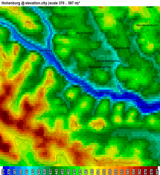
Below is the Elevation map of Hohenburg, which displays elevation range with different colors. Scale of the first map is from 370 to 587 m (1214 to 1926 ft) with average elevation of 465.6 meters (=1528 ft) [note 1]
These maps also provides idea of topography and contour of this city, they are displayed at different zoom levels. More info about maps, scale and edge coordinates you can find below images.
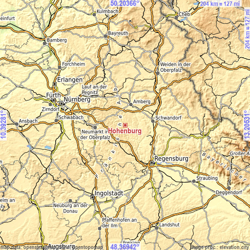
| \ | Map #1 | Topo.Map |
| Scale [m] | 370..587 m | × |
| Scale [ft] | 1214..1926 ft | × |
| Average | 465.6 m = 1528 ft | × |
| Width | 6.37 km = 4 mi | 203.9 km = 126.7 mi |
| Height | 6.37 km = 4 mi | 203.9 km = 126.7 mi |
| ↑Max Latitude | 49.323721° | 50.20366° |
| Latitude at center | 49.29507° | 49.29507° |
| ↓Min Latitude | 49.266402° | 48.36942° |
| ← Min Longitude | 11.755115° | 10.39281° |
| Longitude center | 11.79906° | 11.79906° |
| →Max Longitude | 11.843005° | 13.20531° |
Nearby cities:
Cities around Hohenburg sort by population:
• Kümmersbruck elevation 396 m
15.2 km,  25°
25°
• Parsberg 535 m
16 km,  201°
201°
• Velburg 505 m
11.6 km,  232°
232°
• Lauterhofen 482 m
16.4 km,  299°
299°
• Ursensollen 538 m
12.3 km,  344°
344°
• Rieden 365 m
10.8 km,  72°
72°
• Kastl 457 m
11.8 km,  314°
314°
• Ebermannsdorf 409 m
14.8 km,  42°
42°
• Schmidmühlen 362 m
9.5 km,  107°
107°
• Lupburg 495 m
15.9 km,  191°
191°
• Ensdorf 373 m
11.1 km,  62°
62°
• Hohenfels 399 m
10.7 km,  160°
160°
Multilingual:
 En español:
Hohenburg elevación 386 m.
 En France:
Hohenburg élévation 386 m.
 Auf Deutsch:
Hohenburg höhe über dem Meeresspiegel ist 386 m.

Sources and notes:
- [note 1] Map square and city borders are not equal. Map elevation data is calculated only from area inside that square.
- [src 1] Elevation data from geonames database provided with same terms of usage.
- [src 2] The elevation map of Hohenburg is generated using elevation data from NASA's 3 arcsec (90m) resolution SRTM data.
- [src 3] Base (background) map © OpenStreetMap contributors tiles are generated by Geofabrik and OpenTopoMap.
Copyright & License:
This Hohenburg Elevation Map is licensed under CC BY-SA. You may reuse any part from this page, if you give a proper credit by linking to this URL:
 More info on terms of use page.