Kastl elevation
Kastl (Bavaria, Upper Palatinate), Germany elevation is 457 meters and Kastl elevation in feet is 1499 ft above sea level [src 1]. Kastl is a populated place (feature code) with elevation that is 199 meters (653 ft) bigger than average city elevation in Germany.
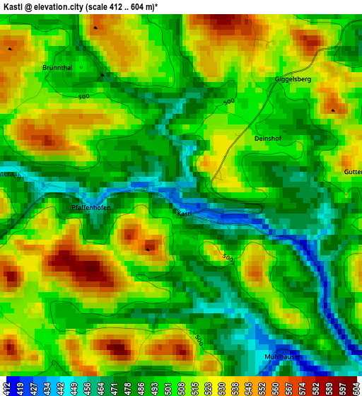
Below is the Elevation map of Kastl, which displays elevation range with different colors. Scale of the first map is from 412 to 604 m (1352 to 1982 ft) with average elevation of 502.1 meters (=1647 ft) [note 1]
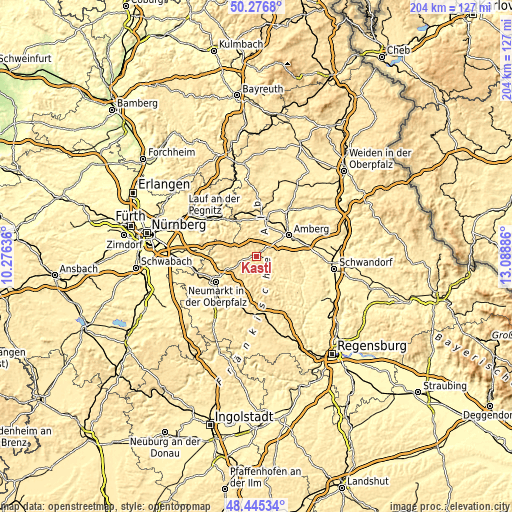
These maps also provides idea of topography and contour of this city, they are displayed at different zoom levels. More info about maps, scale and edge coordinates you can find below images.
| \ | Map #1 | Topo.Map |
| Scale [m] | 412..604 m | × |
| Scale [ft] | 1352..1982 ft | × |
| Average | 502.1 m = 1647 ft | × |
| Width | 6.36 km = 4 mi | 203.6 km = 126.5 mi |
| Height | 6.36 km = 4 mi | 203.6 km = 126.5 mi |
| ↑Max Latitude | 49.398208° | 50.2768° |
| Latitude at center | 49.3696° | 49.3696° |
| ↓Min Latitude | 49.340975° | 48.44534° |
| ← Min Longitude | 11.638665° | 10.27636° |
| Longitude center | 11.68261° | 11.68261° |
| →Max Longitude | 11.726555° | 13.08886° |
Nearby cities:
Cities around Kastl sort by population:
• Amberg elevation 373 m
15.4 km,  57°
57°
• Sulzbach-Rosenberg 399 m
15.3 km,  17°
17°
• Kümmersbruck 396 m
15.9 km,  69°
69°
• Velburg 505 m
15.3 km,  182°
182°
• Lauterhofen 482 m
5.8 km,  268°
268°
• Ursensollen 538 m
6.4 km, 55°
• Poppenricht 419 m
14.4 km,  35°
35°
• Pilsach 443 m
14.1 km,  247°
247°
• Illschwang 488 m
8.9 km,  0°
0°
• Ammerthal 443 m
9.8 km, 35°
• Hohenburg 386 m
11.8 km,  134°
134°
• Alfeld 481 m
11.9 km,  306°
306°
Multilingual:
 En español:
Kastl elevación 457 m.
 En France:
Kastl élévation 457 m.


Sources and notes:
- [note 1] Map square and city borders are not equal. Map elevation data is calculated only from area inside that square.
- [src 1] Elevation data from geonames database provided with same terms of usage.
- [src 2] The elevation map of Kastl is generated using elevation data from NASA's 3 arcsec (90m) resolution SRTM data.
- [src 3] Base (background) map © OpenStreetMap contributors tiles are generated by Geofabrik and OpenTopoMap.
Copyright & License:
This Kastl Elevation Map is licensed under CC BY-SA. You may reuse any part from this page, if you give a proper credit by linking to this URL:
 More info on terms of use page.