Hohentengen elevation
Hohentengen (Baden-Württemberg, Tübingen Region), Germany elevation is 575 meters and Hohentengen elevation in feet is 1886 ft above sea level [src 1]. Hohentengen is a seat of a fourth-order administrative division (feature code) with elevation that is 317 meters (1040 ft) bigger than average city elevation in Germany.
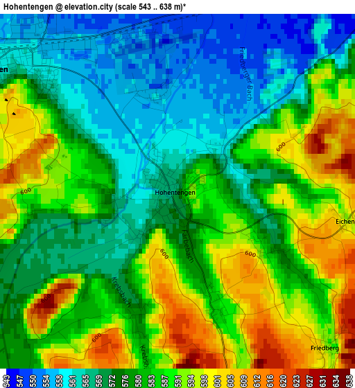
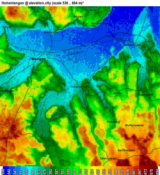
Below is the Elevation map of Hohentengen, which displays elevation range with different colors. Scale of the first map is from 543 to 638 m (1781 to 2093 ft) with average elevation of 580.3 meters (=1904 ft) [note 1]
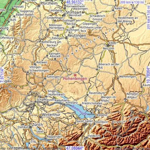
These maps also provides idea of topography and contour of this city, they are displayed at different zoom levels. More info about maps, scale and edge coordinates you can find below images.
| \ | Map #1 | Map #2 | Topo.Map |
| Scale [m] | 543..638 m | 536..684 m | × |
| Scale [ft] | 1781..2093 ft | 1759..2244 ft | × |
| Average | 580.3 m = 1904 ft | 594.9 m = 1952 ft | × |
| Width | 6.54 km = 4.1 mi | 13.07 km = 8.1 mi | 209.1 km = 129.9 mi |
| Height | 6.54 km = 4.1 mi | 13.07 km = 8.1 mi | 209.1 km = 129.9 mi |
| ↑Max Latitude | 48.05884° | 48.088203° | 48.96132° |
| Latitude at center | 48.02946° | 48.02946° | 48.02946° |
| ↓Min Latitude | 48.000063° | 47.97065° | 47.08044° |
| ← Min Longitude | 9.333445° | 9.289499° | 7.97114° |
| Longitude center | 9.37739° | 9.37739° | 9.37739° |
| →Max Longitude | 9.421335° | 9.465281° | 10.78364° |
Nearby cities:
Cities around Hohentengen sort by population:
• Saulgau elevation 590 m
9.3 km,  98°
98°
• Sigmaringen 592 m
12.7 km,  300°
300°
• Mengen 562 m
4.2 km, 302°
• Ostrach 610 m
8.8 km,  177°
177°
• Ertingen 572 m
10.3 km,  40°
40°
• Krauchenwies 585 m
9.8 km,  261°
261°
• Herbertingen 546 m
5.9 km,  45°
45°
• Sigmaringendorf 568 m
9.5 km, 295°
• Langenenslingen 573 m
13.2 km,  0°
0°
• Bingen 610 m
12 km,  319°
319°
• Scheer 561 m
7.8 km,  308°
308°
• Ennetach 560 m
5 km, 300°
Multilingual:
 En español:
Hohentengen elevación 575 m.
 En France:
Hohentengen élévation 575 m.
 Auf Deutsch:
Hohentengen höhe über dem Meeresspiegel ist 575 m.

Sources and notes:
- [note 1] Map square and city borders are not equal. Map elevation data is calculated only from area inside that square.
- [src 1] Elevation data from geonames database provided with same terms of usage.
- [src 2] The elevation map of Hohentengen is generated using elevation data from NASA's 3 arcsec (90m) resolution SRTM data.
- [src 3] Base (background) map © OpenStreetMap contributors tiles are generated by Geofabrik and OpenTopoMap.
Copyright & License:
This Hohentengen Elevation Map is licensed under CC BY-SA. You may reuse any part from this page, if you give a proper credit by linking to this URL:
 More info on terms of use page.