Hoym elevation
Hoym (Saxony-Anhalt), Germany elevation is 130 meters and Hoym elevation in feet is 427 ft above sea level [src 1]. Hoym is a populated place (feature code) with elevation that is 128 meters (420 ft) smaller than average city elevation in Germany.
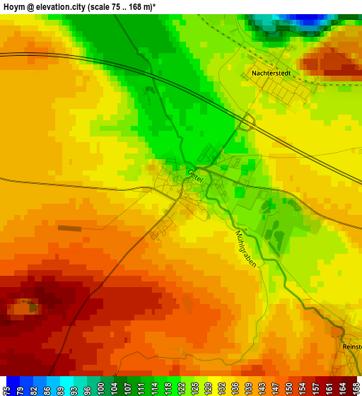
Below is the Elevation map of Hoym, which displays elevation range with different colors. Scale of the first map is from 75 to 168 m (246 to 551 ft) with average elevation of 134.7 meters (=442 ft) [note 1]
These maps also provides idea of topography and contour of this city, they are displayed at different zoom levels. More info about maps, scale and edge coordinates you can find below images.
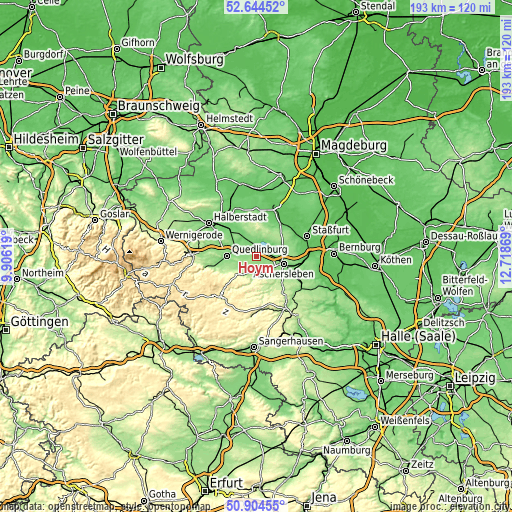
| \ | Map #1 | Topo.Map |
| Scale [m] | 75..168 m | × |
| Scale [ft] | 246..551 ft | × |
| Average | 134.7 m = 442 ft | × |
| Width | 6.05 km = 3.8 mi | 193.5 km = 120.2 mi |
| Height | 6.05 km = 3.8 mi | 193.5 km = 120.2 mi |
| ↑Max Latitude | 51.810098° | 52.64452° |
| Latitude at center | 51.78292° | 51.78292° |
| ↓Min Latitude | 51.755725° | 50.90455° |
| ← Min Longitude | 11.268495° | 9.90619° |
| Longitude center | 11.31244° | 11.31244° |
| →Max Longitude | 11.356385° | 12.71869° |
Nearby cities:
Cities around Hoym sort by population:
• Aschersleben elevation 115 m
10.6 km,  105°
105°
• Quedlinburg 123 m
11.2 km,  273°
273°
• Ballenstedt 228 m
9 km,  217°
217°
• Gernrode 211 m
13.5 km,  241°
241°
• Gatersleben 111 m
4.7 km,  337°
337°
• Nachterstedt 129 m
2.5 km,  37°
37°
• Rieder 193 m
11.4 km, 241°
• Ditfurt 123 m
9.5 km,  305°
305°
• Bad Suderode 213 m
14.6 km,  247°
247°
• Hedersleben 106 m
9.5 km,  333°
333°
• Frose 120 m
4.8 km,  72°
72°
• Cochstedt 106 m
13 km,  31°
31°
Multilingual:
 En español:
Hoym elevación 130 m.
 En France:
Hoym élévation 130 m.


Sources and notes:
- [note 1] Map square and city borders are not equal. Map elevation data is calculated only from area inside that square.
- [src 1] Elevation data from geonames database provided with same terms of usage.
- [src 2] The elevation map of Hoym is generated using elevation data from NASA's 3 arcsec (90m) resolution SRTM data.
- [src 3] Base (background) map © OpenStreetMap contributors tiles are generated by Geofabrik and OpenTopoMap.
Copyright & License:
This Hoym Elevation Map is licensed under CC BY-SA. You may reuse any part from this page, if you give a proper credit by linking to this URL:
 More info on terms of use page.