Gernrode elevation
Gernrode (Saxony-Anhalt), Germany elevation is 211 meters and Gernrode elevation in feet is 692 ft above sea level [src 1]. Gernrode is a populated place (feature code) with elevation that is 47 meters (154 ft) smaller than average city elevation in Germany.
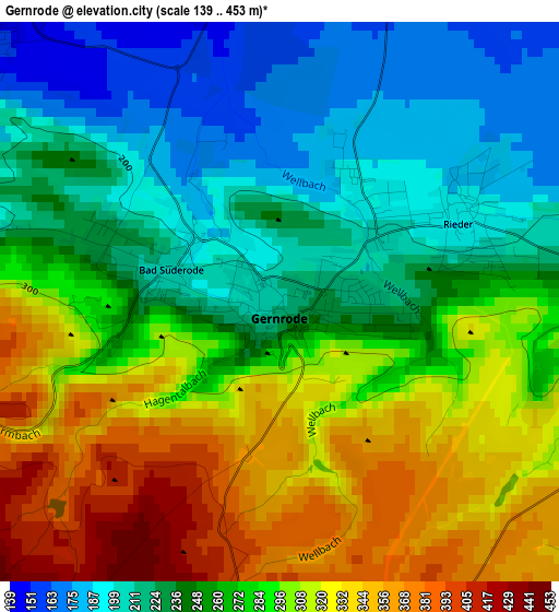
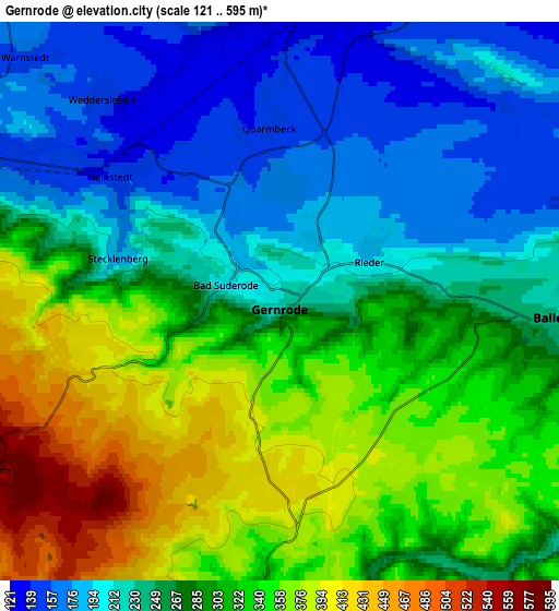
Below is the Elevation map of Gernrode, which displays elevation range with different colors. Scale of the first map is from 139 to 453 m (456 to 1486 ft) with average elevation of 270.4 meters (=887 ft) [note 1]
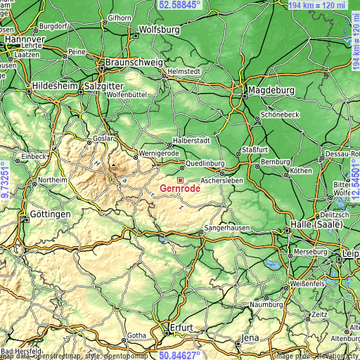
These maps also provides idea of topography and contour of this city, they are displayed at different zoom levels. More info about maps, scale and edge coordinates you can find below images.
| \ | Map #1 | Map #2 | Topo.Map |
| Scale [m] | 139..453 m | 121..595 m | × |
| Scale [ft] | 456..1486 ft | 397..1952 ft | × |
| Average | 270.4 m = 887 ft | 282.8 m = 928 ft | × |
| Width | 6.05 km = 3.8 mi | 12.11 km = 7.5 mi | 193.7 km = 120.4 mi |
| Height | 6.05 km = 3.8 mi | 12.11 km = 7.5 mi | 193.7 km = 120.4 mi |
| ↑Max Latitude | 51.752963° | 51.780159° | 52.58845° |
| Latitude at center | 51.72575° | 51.72575° | 51.72575° |
| ↓Min Latitude | 51.698521° | 51.671275° | 50.84627° |
| ← Min Longitude | 11.094815° | 11.050869° | 9.73251° |
| Longitude center | 11.13876° | 11.13876° | 11.13876° |
| →Max Longitude | 11.182705° | 11.226651° | 12.54501° |
Nearby cities:
Cities around Gernrode sort by population:
• Quedlinburg elevation 123 m
7 km,  6°
6°
• Thale 174 m
7.2 km,  290°
290°
• Ballenstedt 228 m
6.5 km,  96°
96°
• Harzgerode 394 m
9.3 km,  178°
178°
• Westerhausen 145 m
10.5 km,  327°
327°
• Rieder 193 m
2.1 km,  66°
66°
• Neinstedt 145 m
4.4 km,  306°
306°
• Ditfurt 123 m
12.7 km,  19°
19°
• Bad Suderode 213 m
1.7 km,  298°
298°
• Timmenrode 199 m
10.4 km, 298°
• Weddersleben 146 m
5.7 km,  320°
320°
• Friedrichsbrunn 522 m
8 km,  240°
240°
Multilingual:
 En español:
Gernrode elevación 211 m.
 En France:
Gernrode élévation 211 m.
 Auf Deutsch:
Gernrode höhe über dem Meeresspiegel ist 211 m.

Sources and notes:
- [note 1] Map square and city borders are not equal. Map elevation data is calculated only from area inside that square.
- [src 1] Elevation data from geonames database provided with same terms of usage.
- [src 2] The elevation map of Gernrode is generated using elevation data from NASA's 3 arcsec (90m) resolution SRTM data.
- [src 3] Base (background) map © OpenStreetMap contributors tiles are generated by Geofabrik and OpenTopoMap.
Copyright & License:
This Gernrode Elevation Map is licensed under CC BY-SA. You may reuse any part from this page, if you give a proper credit by linking to this URL:
 More info on terms of use page.