Illertissen elevation
Illertissen (Bavaria, Swabia), Germany elevation is 516 meters and Illertissen elevation in feet is 1693 ft above sea level [src 1]. Illertissen is a populated place (feature code) with elevation that is 258 meters (846 ft) bigger than average city elevation in Germany.
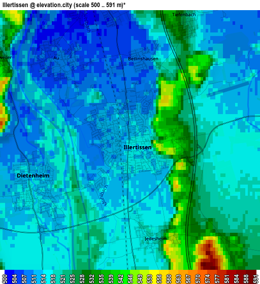
Below is the Elevation map of Illertissen, which displays elevation range with different colors. Scale of the first map is from 500 to 591 m (1640 to 1939 ft) with average elevation of 517.2 meters (=1697 ft) [note 1]
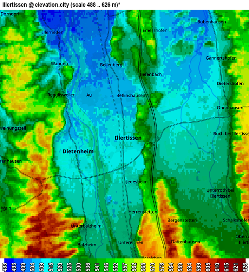
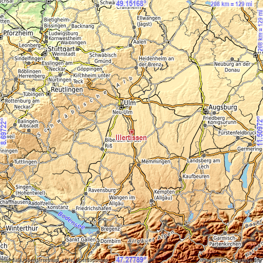
These maps also provides idea of topography and contour of this city, they are displayed at different zoom levels. More info about maps, scale and edge coordinates you can find below images.
| \ | Map #1 | Map #2 | Topo.Map |
| Scale [m] | 500..591 m | 488..626 m | × |
| Scale [ft] | 1640..1939 ft | 1601..2054 ft | × |
| Average | 517.2 m = 1697 ft | 533.9 m = 1752 ft | × |
| Width | 6.51 km = 4 mi | 13.02 km = 8.1 mi | 208.3 km = 129.4 mi |
| Height | 6.51 km = 4 mi | 13.02 km = 8.1 mi | 208.3 km = 129.4 mi |
| ↑Max Latitude | 48.252629° | 48.281882° | 49.15168° |
| Latitude at center | 48.22336° | 48.22336° | 48.22336° |
| ↓Min Latitude | 48.194074° | 48.164771° | 47.27789° |
| ← Min Longitude | 10.059525° | 10.015579° | 8.69722° |
| Longitude center | 10.10347° | 10.10347° | 10.10347° |
| →Max Longitude | 10.147415° | 10.191361° | 11.50972° |
Nearby cities:
Cities around Illertissen sort by population:
• Weißenhorn elevation 503 m
10 km,  24°
24°
• Vöhringen 499 m
6.3 km,  345°
345°
• Dietenheim 513 m
2.7 km,  239°
239°
• Schwendi 528 m
11 km, 240°
• Altenstadt 528 m
7.1 km,  173°
173°
• Bellenberg 504 m
3.9 km, 346°
• Buch 545 m
5.7 km,  88°
88°
• Illerrieden 500 m
6.5 km,  323°
323°
• Roggenburg 553 m
11.1 km,  58°
58°
• Kirchberg an der Iller 537 m
10.1 km,  188°
188°
• Wain 545 m
7.2 km, 238°
• Schnürpflingen 517 m
9.9 km,  303°
303°
Multilingual:
 En español:
Illertissen elevación 516 m.
 En France:
Illertissen élévation 516 m.
 Auf Deutsch:
Illertissen höhe über dem Meeresspiegel ist 516 m.

Sources and notes:
- [note 1] Map square and city borders are not equal. Map elevation data is calculated only from area inside that square.
- [src 1] Elevation data from geonames database provided with same terms of usage.
- [src 2] The elevation map of Illertissen is generated using elevation data from NASA's 3 arcsec (90m) resolution SRTM data.
- [src 3] Base (background) map © OpenStreetMap contributors tiles are generated by Geofabrik and OpenTopoMap.
Copyright & License:
This Illertissen Elevation Map is licensed under CC BY-SA. You may reuse any part from this page, if you give a proper credit by linking to this URL:
 More info on terms of use page.