Jahnsdorf elevation
Jahnsdorf (Saxony), Germany elevation is 395 meters and Jahnsdorf elevation in feet is 1296 ft above sea level [src 1]. Jahnsdorf is a populated place (feature code) with elevation that is 137 meters (449 ft) bigger than average city elevation in Germany.
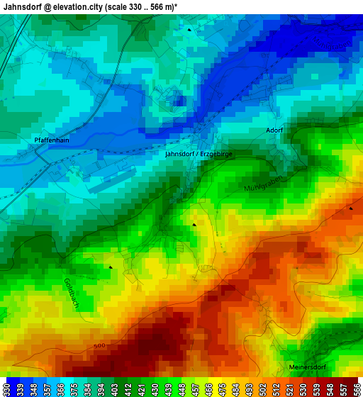
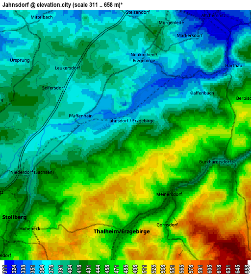
Below is the Elevation map of Jahnsdorf, which displays elevation range with different colors. Scale of the first map is from 330 to 566 m (1083 to 1857 ft) with average elevation of 424.8 meters (=1394 ft) [note 1]
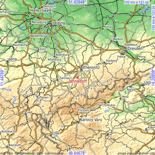
These maps also provides idea of topography and contour of this city, they are displayed at different zoom levels. More info about maps, scale and edge coordinates you can find below images.
| \ | Map #1 | Map #2 | Topo.Map |
| Scale [m] | 330..566 m | 311..658 m | × |
| Scale [ft] | 1083..1857 ft | 1020..2159 ft | × |
| Average | 424.8 m = 1394 ft | 433.1 m = 1421 ft | × |
| Width | 6.18 km = 3.8 mi | 12.37 km = 7.7 mi | 197.9 km = 123 mi |
| Height | 6.18 km = 3.8 mi | 12.37 km = 7.7 mi | 197.9 km = 123 mi |
| ↑Max Latitude | 50.772889° | 50.800672° | 51.62649° |
| Latitude at center | 50.74509° | 50.74509° | 50.74509° |
| ↓Min Latitude | 50.717274° | 50.689442° | 49.84678° |
| ← Min Longitude | 12.810195° | 12.766249° | 11.44789° |
| Longitude center | 12.85414° | 12.85414° | 12.85414° |
| →Max Longitude | 12.898085° | 12.942031° | 14.26039° |
Nearby cities:
Cities around Jahnsdorf sort by population:
• Stollberg elevation 417 m
6.5 km,  233°
233°
• Lugau 407 m
7.5 km,  264°
264°
• Thalheim 443 m
4.9 km,  183°
183°
• Neukirchen 354 m
3.9 km,  13°
13°
• Burkhardtsdorf 405 m
4.6 km,  106°
106°
• Gelenau 460 m
8.8 km,  115°
115°
• Gersdorf 329 m
9.7 km,  273°
273°
• Gornsdorf 461 m
5.4 km,  157°
157°
• Kirchberg 388 m
6.5 km,  286°
286°
• Dorfchemnitz 474 m
9.1 km,  187°
187°
• Hormersdorf 528 m
8.1 km,  166°
166°
• Niederdorf 403 m
5.2 km,  246°
246°
Multilingual:
 En español:
Jahnsdorf elevación 395 m.
 En France:
Jahnsdorf élévation 395 m.
 Auf Deutsch:
Jahnsdorf höhe über dem Meeresspiegel ist 395 m.

Sources and notes:
- [note 1] Map square and city borders are not equal. Map elevation data is calculated only from area inside that square.
- [src 1] Elevation data from geonames database provided with same terms of usage.
- [src 2] The elevation map of Jahnsdorf is generated using elevation data from NASA's 3 arcsec (90m) resolution SRTM data.
- [src 3] Base (background) map © OpenStreetMap contributors tiles are generated by Geofabrik and OpenTopoMap.
Copyright & License:
This Jahnsdorf Elevation Map is licensed under CC BY-SA. You may reuse any part from this page, if you give a proper credit by linking to this URL:
 More info on terms of use page.