Jandelsbrunn elevation
Jandelsbrunn (Bavaria, Lower Bavaria), Germany elevation is 630 meters and Jandelsbrunn elevation in feet is 2067 ft above sea level [src 1]. Jandelsbrunn is a seat of a fourth-order administrative division (feature code) with elevation that is 372 meters (1220 ft) bigger than average city elevation in Germany.
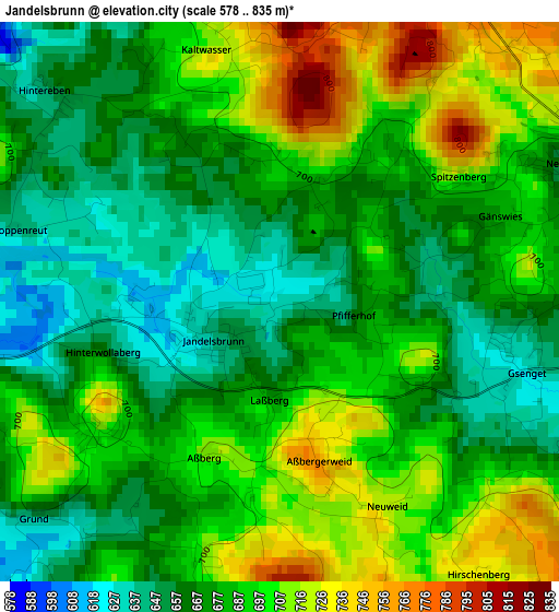
Below is the Elevation map of Jandelsbrunn, which displays elevation range with different colors. Scale of the first map is from 578 to 835 m (1896 to 2740 ft) with average elevation of 682.6 meters (=2240 ft) [note 1]
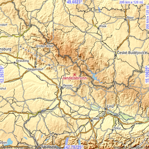
These maps also provides idea of topography and contour of this city, they are displayed at different zoom levels. More info about maps, scale and edge coordinates you can find below images.
| \ | Map #1 | Topo.Map |
| Scale [m] | 578..835 m | × |
| Scale [ft] | 1896..2740 ft | × |
| Average | 682.6 m = 2240 ft | × |
| Width | 6.45 km = 4 mi | 206.3 km = 128.2 mi |
| Height | 6.45 km = 4 mi | 206.2 km = 128.1 mi |
| ↑Max Latitude | 48.762306° | 49.6523° |
| Latitude at center | 48.73333° | 48.73333° |
| ↓Min Latitude | 48.704337° | 47.79725° |
| ← Min Longitude | 13.656055° | 12.29375° |
| Longitude center | 13.7° | 13.7° |
| →Max Longitude | 13.743945° | 15.10625° |
Nearby cities:
Cities around Jandelsbrunn sort by population:
• Hauzenberg elevation 526 m
10.8 km,  210°
210°
• Waldkirchen 547 m
7.3 km,  269°
269°
• Freyung 653 m
14 km,  307°
307°
• Wegscheid 716 m
16 km,  156°
156°
• Röhrnbach 432 m
13 km, 272°
• Neureichenau 668 m
3.8 km,  63°
63°
• Büchlberg 472 m
14.8 km,  242°
242°
• Hinterschmiding 746 m
12.2 km,  324°
324°
• Grainet 694 m
8.3 km,  333°
333°
• Breitenberg 690 m
7.6 km,  115°
115°
• Sonnen 802 m
5.7 km,  167°
167°
• Haidmühle 833 m
11.7 km,  28°
28°
Multilingual:
 En español:
Jandelsbrunn elevación 630 m.
 En France:
Jandelsbrunn élévation 630 m.
 Auf Deutsch:
Jandelsbrunn höhe über dem Meeresspiegel ist 630 m.

Sources and notes:
- [note 1] Map square and city borders are not equal. Map elevation data is calculated only from area inside that square.
- [src 1] Elevation data from geonames database provided with same terms of usage.
- [src 2] The elevation map of Jandelsbrunn is generated using elevation data from NASA's 3 arcsec (90m) resolution SRTM data.
- [src 3] Base (background) map © OpenStreetMap contributors tiles are generated by Geofabrik and OpenTopoMap.
Copyright & License:
This Jandelsbrunn Elevation Map is licensed under CC BY-SA. You may reuse any part from this page, if you give a proper credit by linking to this URL:
 More info on terms of use page.