Kirchberg elevation
Kirchberg (Saxony), Germany elevation is 351 meters and Kirchberg elevation in feet is 1152 ft above sea level [src 1]. Kirchberg is a populated place (feature code) with elevation that is 93 meters (305 ft) bigger than average city elevation in Germany.
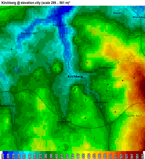
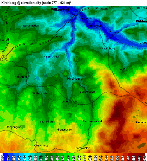
Below is the Elevation map of Kirchberg, which displays elevation range with different colors. Scale of the first map is from 299 to 561 m (981 to 1841 ft) with average elevation of 401.4 meters (=1317 ft) [note 1]
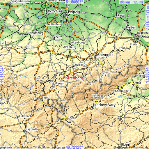
These maps also provides idea of topography and contour of this city, they are displayed at different zoom levels. More info about maps, scale and edge coordinates you can find below images.
| \ | Map #1 | Map #2 | Topo.Map |
| Scale [m] | 299..561 m | 277..621 m | × |
| Scale [ft] | 981..1841 ft | 909..2037 ft | × |
| Average | 401.4 m = 1317 ft | 424.6 m = 1393 ft | × |
| Width | 6.2 km = 3.9 mi | 12.4 km = 7.7 mi | 198.4 km = 123.3 mi |
| Height | 6.2 km = 3.9 mi | 12.4 km = 7.7 mi | 198.4 km = 123.3 mi |
| ↑Max Latitude | 50.649772° | 50.677628° | 51.50563° |
| Latitude at center | 50.6219° | 50.6219° | 50.6219° |
| ↓Min Latitude | 50.594011° | 50.566106° | 49.72125° |
| ← Min Longitude | 12.480545° | 12.436599° | 11.11824° |
| Longitude center | 12.52449° | 12.52449° | 12.52449° |
| →Max Longitude | 12.568435° | 12.612381° | 13.93074° |
Nearby cities:
Cities around Kirchberg sort by population:
• Zwickau elevation 267 m
12 km,  347°
347°
• Schneeberg 469 m
8.8 km,  110°
110°
• Wilkau-Haßlau 279 m
5.9 km, 353°
• Reinsdorf 325 m
8.7 km,  14°
14°
• Lichtentanne 325 m
10.5 km,  318°
318°
• Zschorlau 501 m
10.8 km,  124°
124°
• Bad Schlema 406 m
10.7 km,  101°
101°
• Hartenstein 365 m
11.2 km,  66°
66°
• Wildenfels 340 m
7.8 km,  49°
49°
• Stützengrün 640 m
9.9 km,  176°
176°
• Hirschfeld 402 m
4.8 km,  273°
273°
• Waldkirchen 427 m
10.6 km,  254°
254°
Multilingual:
 En español:
Kirchberg elevación 351 m.
 En France:
Kirchberg élévation 351 m.
 Auf Deutsch:
Kirchberg höhe über dem Meeresspiegel ist 351 m.

Sources and notes:
- [note 1] Map square and city borders are not equal. Map elevation data is calculated only from area inside that square.
- [src 1] Elevation data from geonames database provided with same terms of usage.
- [src 2] The elevation map of Kirchberg is generated using elevation data from NASA's 3 arcsec (90m) resolution SRTM data.
- [src 3] Base (background) map © OpenStreetMap contributors tiles are generated by Geofabrik and OpenTopoMap.
Copyright & License:
This Kirchberg Elevation Map is licensed under CC BY-SA. You may reuse any part from this page, if you give a proper credit by linking to this URL:
 More info on terms of use page.