Kirn elevation
Kirn (Rheinland-Pfalz), Germany elevation is 201 meters and Kirn elevation in feet is 659 ft above sea level [src 1]. Kirn is a populated place (feature code) with elevation that is 57 meters (187 ft) smaller than average city elevation in Germany.
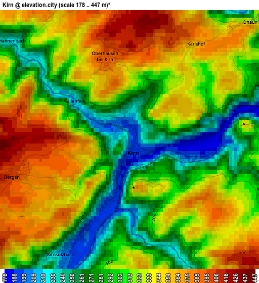
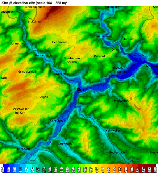
Below is the Elevation map of Kirn, which displays elevation range with different colors. Scale of the first map is from 178 to 447 m (584 to 1467 ft) with average elevation of 318.3 meters (=1044 ft) [note 1]
These maps also provides idea of topography and contour of this city, they are displayed at different zoom levels. More info about maps, scale and edge coordinates you can find below images.
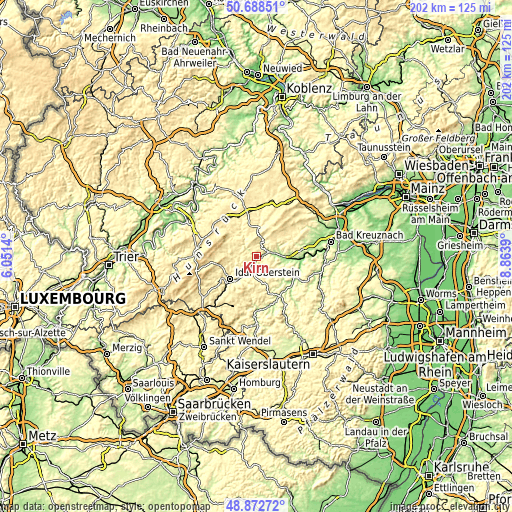
| \ | Map #1 | Map #2 | Topo.Map |
| Scale [m] | 178..447 m | 164..568 m | × |
| Scale [ft] | 584..1467 ft | 538..1864 ft | × |
| Average | 318.3 m = 1044 ft | 338.7 m = 1111 ft | × |
| Width | 6.31 km = 3.9 mi | 12.62 km = 7.8 mi | 201.9 km = 125.5 mi |
| Height | 6.31 km = 3.9 mi | 12.62 km = 7.8 mi | 201.9 km = 125.5 mi |
| ↑Max Latitude | 49.817483° | 49.845829° | 50.68851° |
| Latitude at center | 49.78912° | 49.78912° | 49.78912° |
| ↓Min Latitude | 49.76074° | 49.732344° | 48.87272° |
| ← Min Longitude | 7.413705° | 7.369759° | 6.0514° |
| Longitude center | 7.45765° | 7.45765° | 7.45765° |
| →Max Longitude | 7.501595° | 7.545541° | 8.8639° |
Nearby cities:
Cities around Kirn sort by population:
• Idar-Oberstein elevation 288 m
13.6 km,  232°
232°
• Rhaunen 344 m
11.7 km,  315°
315°
• Simmertal 189 m
5.2 km,  63°
63°
• Monzingen 184 m
9.7 km,  84°
84°
• Hochstetten-Dhaun 250 m
3.3 km,  68°
68°
• Staudernheim 141 m
16.7 km,  94°
94°
• Merxheim 180 m
7.4 km, 86°
• Meddersheim 165 m
11.5 km,  97°
97°
• Hennweiler 358 m
3.5 km,  330°
330°
• Gemünden 283 m
11.8 km,  6°
6°
• Kirschweiler 485 m
15.5 km,  253°
253°
• Bundenbach 393 m
8.3 km, 316°
Multilingual:
 En español:
Kirn elevación 201 m.
 En France:
Kirn élévation 201 m.


Sources and notes:
- [note 1] Map square and city borders are not equal. Map elevation data is calculated only from area inside that square.
- [src 1] Elevation data from geonames database provided with same terms of usage.
- [src 2] The elevation map of Kirn is generated using elevation data from NASA's 3 arcsec (90m) resolution SRTM data.
- [src 3] Base (background) map © OpenStreetMap contributors tiles are generated by Geofabrik and OpenTopoMap.
Copyright & License:
This Kirn Elevation Map is licensed under CC BY-SA. You may reuse any part from this page, if you give a proper credit by linking to this URL:
 More info on terms of use page.